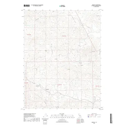
2018 Map of Yorkville
USGS Topo · Published 2018About this map
Yorkville and The Oaks serve as the primary residential anchors in this part of Mendocino County, where the landscape is defined by the high ridges separating the Sanel Valley from the surrounding highlands. The complex hydrology of the region is evident in the numerous drainages such as Feliz Cr, Cummiskey Cr, and Elkhorn Cr, which carve through the terrain between prominent peaks. These elevations, including Duncan Peak, Snow Mtn, and Lookout Mtn, dominate the horizon and provide the vertical relief that historically influenced road placement and land use. Local landmarks such as Pregnant Spring and Saddle Spring indicate reliable water sources in a terrain otherwise characterized by steep slopes and narrow valleys. This map illustrates the modern road network, from Old Hopland 110 Rd to the more specialized Pomo Tierra Ranch Rd, reflecting the continued importance of these routes for ranching and rural access.
Find a feature on this map
38 named features on this map. Tap any name to fly to it.
Don’t see what you’re looking for? This feature index may not catch every label — zoom into the map to look around manually.
Map Details
Editions of this 2018 Yorkville Map
This is the sole edition of this map. No revisions or reprints were ever made.
Other maps of this area

1920 · Ukiah
USGS Topo · 1:62,500

1938 · Hopland
USGS Topo · 1:62,500

1943 · Boonville
USGS Topo · 1:62,500

1943 · Hopland
USGS Topo · 1:62,500

1943 · Ornbaun
USGS Topo · 1:62,500

1944 · Ukiah
USGS Topo · 1:62,500

1944 · Ornbaun
USGS Topo · 1:62,500

1944 · Hopland
USGS Topo · 1:62,500

1947 · Santa Rosa
USGS Topo · 1:250,000

1949 · Santa Rosa
USGS Topo · 1:250,000