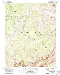
1990 Map of Yosemite Falls
USGS Topo · Published 1990About this map
Yosemite Village serves as the primary hub of activity on this 1990 survey, showing the complex layout of the Courthouse and surrounding administrative structures at the base of the canyon walls. The map details the dramatic verticality of the landscape, from the high points of Mount Hoffmann and North Dome to the plummeting waters of Upper Yosemite Fall and Lower Yosemite Fall. This period of park management is reflected in the established Yosemite Wilderness boundaries and developed visitor sites like Yosemite Creek Campground and the Picnic Area along Yosemite Creek.
Find a feature on this map
45 named features on this map. Tap any name to fly to it.
Don’t see what you’re looking for? This feature index may not catch every label — zoom into the map to look around manually.
Map Details
Editions of this 1990 Yosemite Falls Map
This is the sole edition of this map. No revisions or reprints were ever made.
Other maps of this area

1897 · Yosemite
USGS Topo · 1:125,000

1900 · Yosemite
USGS Topo · 1:125,000

1901 · Mt. Lyell
USGS Topo · 1:125,000

1903 · Yosemite
USGS Topo · 1:125,000

1909 · Yosemite
USGS Topo · 1:125,000

1947 · Mariposa
USGS Topo · 1:250,000

1948 · Mariposa
USGS Topo · 1:250,000

1953 · Merced Peak
USGS Topo · 1:62,500

1956 · Hetch Hetchy Reservoir
USGS Topo · 1:62,500

1956 · Tuolumne Meadows
USGS Topo · 1:62,500