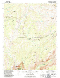
1992 Map of Yosemite Falls
USGS Topo · Published 1995About this map
Yosemite Village serves as the focal point of human activity at the southern edge of this study, positioned near the valley floor where the Courthouse and the administrative reach of the Yosemite National Park meet the high Sierra. The map details the dramatic verticality of the landscape, tracing the descent of Upper Yosemite Fall and Lower Yosemite Fall into the valley. Beyond the developed corridor, the Yosemite Wilderness dominates the central and northern sections, accessible via Tioga Road and a network of remote sites like the Snow Creek Ranger Cabin. The drainage of Yosemite Creek and the granite massifs of Half Dome, North Dome, and Mount Hoffmann illustrate the complex glacially-carved topography that defines the Tuolumne and Mariposa county line.
Find a feature on this map
50 named features on this map. Tap any name to fly to it.
Don’t see what you’re looking for? This feature index may not catch every label — zoom into the map to look around manually.
Map Details
Editions of this 1992 Yosemite Falls Map
This is the sole edition of this map. No revisions or reprints were ever made.
Other maps of this area

1897 · Yosemite
USGS Topo · 1:125,000

1900 · Yosemite
USGS Topo · 1:125,000

1901 · Mt. Lyell
USGS Topo · 1:125,000

1903 · Yosemite
USGS Topo · 1:125,000

1909 · Yosemite
USGS Topo · 1:125,000

1947 · Mariposa
USGS Topo · 1:250,000

1948 · Mariposa
USGS Topo · 1:250,000

1953 · Merced Peak
USGS Topo · 1:62,500

1956 · Hetch Hetchy Reservoir
USGS Topo · 1:62,500

1956 · Tuolumne Meadows
USGS Topo · 1:62,500