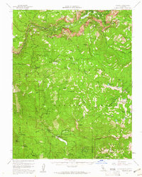
1956 Map of Yosemite
USGS Topo · Published 1961About this map
El Capitan and Half Dome tower over the valley floor in this mid-century survey of the high Sierra landscape. The map details the early development of recreational infrastructure, from the Badger Pass Ski Area to several established campgrounds such as Stovepipe Campground and Crowsfoot Campground. A network of early automobile routes including Wawona Road and Glacier Point Road provides access to world-famous natural features, while administrative points like Chinquapin Ranger Sta and the South Entrance Sta mark the management of the park's expanding traffic.
Find a feature on this map
158 named features on this map. Tap any name to fly to it.
Don’t see what you’re looking for? This feature index may not catch every label — zoom into the map to look around manually.
Map Details
Editions of this 1956 Yosemite Map
4 editions found
Other maps of this area

1897 · Yosemite
USGS Topo · 1:125,000

1900 · Yosemite
USGS Topo · 1:125,000

1901 · Mt. Lyell
USGS Topo · 1:125,000

1903 · Yosemite
USGS Topo · 1:125,000

1904 · Kaiser
USGS Topo · 1:125,000

1909 · Yosemite
USGS Topo · 1:125,000

1912 · Mariposa
USGS Topo · 1:125,000

1947 · El Portal
USGS Topo · 1:24,000

1947 · Mariposa
USGS Topo · 1:250,000

1947 · El Portal
USGS Topo · 1:62,500