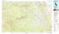
1976 Map of Yosemite Valley
USGS Topo · Published 1994About this map
Yosemite Valley is the central focus of this mid-1970s study, which captures the Sierra Nevada's high country during a period of transition in National Park management. The map documents the layout of primary visitor hubs like Yosemite Village and Curry Village alongside the critical gateway community of El Portal on the Merced River. Farther south, the historic settlement of Wawona stands near the park boundary, while the northern reaches are dominated by the Hetch Hetchy Reservoir and the Grand Canyon of the Tuolumne River. Beyond the famous monoliths of El Capitan and Half Dome, the map details the vast wilderness infrastructure of the Cathedral Range and the Minarets Range. Small-scale industrial remnants, such as the Abernathy Mine and Sawmill Mine, persist in the surrounding Stanislaus National Forest and Sierra National Forest, illustrating the overlap of conservation and resource extraction in the High Sierra.
Find a feature on this map
48 named features on this map. Tap any name to fly to it.
Don’t see what you’re looking for? This feature index may not catch every label — zoom into the map to look around manually.
Map Details
Editions of this 1976 Yosemite Valley Map
2 editions found
Other maps of this area

1891 · Big Trees
USGS Topo · 1:125,000

1893 · Sonora
USGS Topo · 1:125,000

1894 · Big Trees
USGS Topo · 1:125,000

1896 · Dardanelles
USGS Topo · 1:125,000

1896 · Sonora
USGS Topo · 1:125,000

1897 · Sonora
USGS Topo · 1:125,000

1897 · Big Trees
USGS Topo · 1:125,000

1897 · Yosemite
USGS Topo · 1:125,000

1898 · Dardanelles
USGS Topo · 1:125,000

1898 · Sonora
USGS Topo · 1:125,000