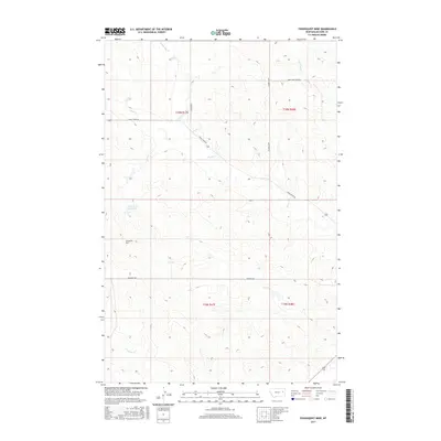
2017 Map of Youngquist Mine
USGS Topo · Published 2017About this map
The Youngquist Mine anchors the western edge of this ranching landscape in McCone County, Montana. This high-plains terrain is defined by a dendritic network of ephemeral drainages, where Denwoody Cr and Lone Tree Cr carve north-facing coulees. The distribution of water is critical in this environment, evidenced by the Groh Stock Reservoir, a localized hub for livestock management amidst the section lines. A modest network of gravel routes, including McKean Rd and Kasner Loop, provides the primary access across the rolling breaks between Horse Cr and Antelope Cr. The map illustrates the persistent intersection of resource extraction and open-range agriculture, with family-named roads like Mayberry Rd and Horse Creek Rd tracing the paths of long-standing regional homesteads.
Find a feature on this map
15 named features on this map. Tap any name to fly to it.
Don’t see what you’re looking for? This feature index may not catch every label — zoom into the map to look around manually.
Map Details
Editions of this 2017 Youngquist Mine Map
This is the sole edition of this map. No revisions or reprints were ever made.
Other maps of this area

1954 · Glendive
USGS Topo · 1:250,000

1957 · Glendive
USGS Topo · 1:250,000

1958 · Glendive
USGS Topo · 1:250,000

1982 · Circle
USGS Topo · 1:100,000

1983 · Youngquist Mine
USGS Topo · 1:24,000

1983 · Brockway NE
USGS Topo · 1:24,000

1983 · Haynie Reservoir
USGS Topo · 1:24,000

1983 · North Fork Horse Creek
USGS Topo · 1:24,000

1983 · Quick Reservoir
USGS Topo · 1:24,000

1983 · Circle
USGS Topo · 1:24,000