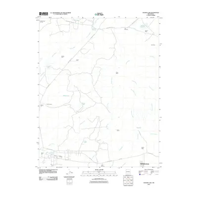
2010 Map of Youngs Lake
USGS Topo · Published 2010About this map
Farmington edges into the southern reaches of this landscape, where the high desert terrain is defined by a complex network of arroyos and man-made water storage. The area is marked by ranching and infrastructure, including the Wallace Ranch and several specialized water features such as Wallace Tank, Harper Tank, and King Tank. These tanks and reservoirs, including Fourmile Reservoir and Locke Lake, suggest the vital importance of water management for livestock and residents in the San Juan Basin.
Find a feature on this map
42 named features on this map. Tap any name to fly to it.
Don’t see what you’re looking for? This feature index may not catch every label — zoom into the map to look around manually.
Map Details
Editions of this 2010 Youngs Lake Map
This is the sole edition of this map. No revisions or reprints were ever made.
Other maps of this area

1889 · Chaco
USGS Topo · 1:250,000

1892 · Chaco
USGS Topo · 1:250,000

1927 · Sulphur Spring
USGS Topo · 1:96,000

1928 · Kirtland
USGS Topo · 1:125,000

1932 · Kirtland
USGS Topo · 1:125,000

1954 · Shiprock
USGS Topo · 1:250,000

1958 · Shiprock
USGS Topo · 1:250,000

1959 · Shiprock
USGS Topo · 1:250,000
1963 · Farmington North
USGS Topo · 1:24,000
1963 · La Plata
USGS Topo · 1:24,000