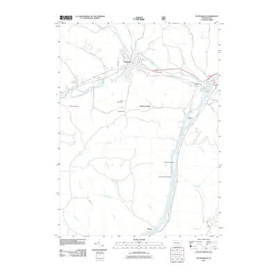
2011 Map of Youngsville
USGS Topo · Published 2011About this map
Brokenstraw Creek converges with the Allegheny River in this detailed topographic study of Warren County, centering on the borough of Youngsville. The landscape is defined by the heavy incision of waterways like Mead Run and Indian Camp Run as they carve through the plateau, creating named landmarks such as York Mountain and Crippen Hill. The settlement pattern follows the valley floor, with the community of Irvine situated at the junction of the creek and river, while the smaller hamlet of Althom sits further south along the riverbank.
Find a feature on this map
59 named features on this map. Tap any name to fly to it.
Don’t see what you’re looking for? This feature index may not catch every label — zoom into the map to look around manually.
Map Details
Editions of this 2011 Youngsville Map
This is the sole edition of this map. No revisions or reprints were ever made.
Other maps of this area

1906 · Warren
USGS Topo · 1:62,500

1907 · Warren
USGS Topo · 1:62,500

1908 · Warren
USGS Topo · 1:62,500

1926 · Youngsville
USGS Topo · 1:62,500

1927 · Tidioute
USGS Topo · 1:48,000

1929 · Youngsville
USGS Topo · 1:62,500

1930 · Tidioute
USGS Topo · 1:62,500

1935 · Sheffield
USGS Topo · 1:48,000

1941 · Sheffield
USGS Topo · 1:62,500

1943 · Youngsville
USGS Topo · 1:62,500
Featured Places
- Youngsville, PA
- Pittsfield Township, PA
- Watson Township, PA
- Conewango Township, PA
- Pleasant Township, PA