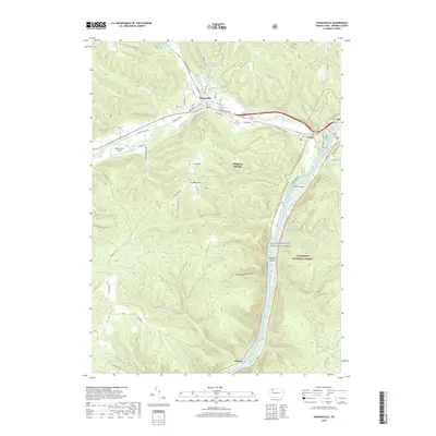
2019 Map of Youngsville
USGS Topo · Published 2019About this map
Youngsville serves as a primary hub where the waters of Matthews Run and Indian Camp Run join Brokenstraw Creek. This 2019 survey captures the developed street grid of the borough, including the Youngsville Byp and residential streets like Highland Ave and College St. To the east, the village of Irvine sits near the confluence of the creek and the Allegheny Wild and Scenic River, a vital corridor for both natural history and recreation.
Find a feature on this map
61 named features on this map. Tap any name to fly to it.
Don’t see what you’re looking for? This feature index may not catch every label — zoom into the map to look around manually.
Map Details
Editions of this 2019 Youngsville Map
This is the sole edition of this map. No revisions or reprints were ever made.
Other maps of this area

1906 · Warren
USGS Topo · 1:62,500

1907 · Warren
USGS Topo · 1:62,500

1908 · Warren
USGS Topo · 1:62,500

1926 · Youngsville
USGS Topo · 1:62,500

1927 · Tidioute
USGS Topo · 1:48,000

1929 · Youngsville
USGS Topo · 1:62,500

1930 · Tidioute
USGS Topo · 1:62,500

1935 · Sheffield
USGS Topo · 1:48,000

1941 · Sheffield
USGS Topo · 1:62,500

1943 · Youngsville
USGS Topo · 1:62,500
Featured Places
- Youngsville, PA
- Pittsfield Township, PA
- Watson Township, PA
- Conewango Township, PA
- Pleasant Township, PA