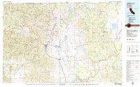
1979 Map of Yreka
USGS Topo · Published 1979About this map
The Klamath Mountains and the broad Shasta Valley dominate this regional 1979 survey, revealing a landscape defined by water and mineral extraction. The city of Yreka serves as the central hub, situated along Interstate 5 and the Southern Pacific rail line. To the east, the Shasta River and Little Shasta River meander through ranching country toward Montague, while the northern border is carved by the Klamath River, now punctuated by the Iron Gate Reservoir and Copco Lake.
Find a feature on this map
138 named features on this map. Tap any name to fly to it.
Don’t see what you’re looking for? This feature index may not catch every label — zoom into the map to look around manually.
Map Details
Editions of this 1979 Yreka Map
This is the sole edition of this map. No revisions or reprints were ever made.
Other maps of this area

1886 · Modoc Lava Bed
USGS Topo · 1:250,000

1886 · Shasta
USGS Topo · 1:250,000

1889 · Klamath
USGS Topo · 1:250,000

1891 · Ashland
USGS Topo · 1:250,000

1892 · Modoc Lava-Bed
USGS Topo · 1:250,000

1893 · Ashland
USGS Topo · 1:250,000

1894 · Klamath
USGS Topo · 1:250,000

1894 · Shasta
USGS Topo · 1:250,000

1897 · Ashland
USGS Topo · 1:250,000

1908 · Grants Pass
USGS Topo · 1:125,000