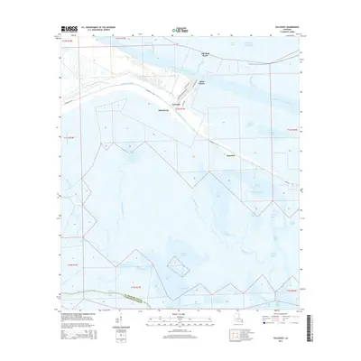
2015 Map of Yscloskey
USGS Topo · Published 2015About this map
Yscloskey and Alluvial City sit at the center of this coastal landscape, where the Mississippi River-Gulf Outlet Canal cuts a massive industrial path through the wetlands of Saint Bernard Parish. This survey illustrates the intricate balance between human settlement and the expansive marshland systems of south Louisiana. The road network, including the Yscloskey Hwy and Hopedale Hwy, follows the natural levees of Bayou la Loutre, connecting small communities like Hopedale and Shell Beach to the interior. Beyond the embankments, the territory is dominated by a complex web of lagoons and tidal passages such as Antonios Lagoon, Inez Lagoon, and Lake Ameda. The mapping shows the Parish boundary where St. Bernard Parish meets Plaquemines Parish, cutting through remote water bodies like Cochon Bay and Bayou Jean Louis Robin.
Find a feature on this map
57 named features on this map. Tap any name to fly to it.
Don’t see what you’re looking for? This feature index may not catch every label — zoom into the map to look around manually.
Map Details
Editions of this 2015 Yscloskey Map
This is the sole edition of this map. No revisions or reprints were ever made.
Other maps of this area

1891 · Pointe a La Hache
USGS Topo · 1:62,500

1892 · St. Bernard
USGS Topo · 1:62,500

1892 · Pointe a La Hache
USGS Topo · 1:62,500

1893 · Shell Beach
USGS Topo · 1:62,500

1893 · Dime
USGS Topo · 1:62,500

1935 · Delacroix
USGS Topo · 1:31,680

1935 · Lake Calebasse
USGS Topo · 1:31,680

1935 · Lake Batola
USGS Topo · 1:31,680

1939 · Shell Beach
USGS Topo · 1:62,500

1939 · Pointe a La Hache
USGS Topo · 1:62,500