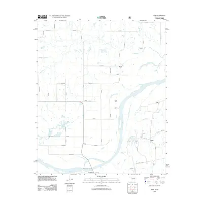
2012 Map of Yuba
USGS Topo · Published 2012About this map
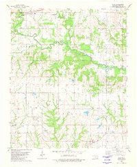
The Red River defines the southern boundary of this region, winding past Sowells Bluff and creating a complex system of drainage across the lowlands. Small agricultural communities such as Yuba, Romia, and Karma are connected by a grid of rural roads, many of which carry descriptive local names like Byrd Store Rd and Sand Pit Rd. The landscape is dominated by seasonal waterways and larger tributaries, including Island Bayou and Wolf Cr, which flow through the northern reaches before joining the main river system.
Find a feature on this map
62 named features on this map. Tap any name to fly to it.
Don’t see what you’re looking for? This feature index may not catch every label — zoom into the map to look around manually.
Map Details
Editions of this 2012 Yuba Map
This is the sole edition of this map. No revisions or reprints were ever made.
Other maps of this area

1954 · Sherman
USGS Topo · 1:250,000

1957 · Wade
USGS Topo · 1:62,500

1958 · Durant
USGS Topo · 1:62,500

1958 · Bonham
USGS Topo · 1:62,500

1958 · Whitesright
USGS Topo · 1:62,500

1958 · Sherman
USGS Topo · 1:250,000
1980 · Telephone
USGS Topo · 1:24,000
1980 · Roberta
USGS Topo · 1:24,000
1980 · Bennington South
USGS Topo · 1:24,000
1980 · Blue
USGS Topo · 1:24,000