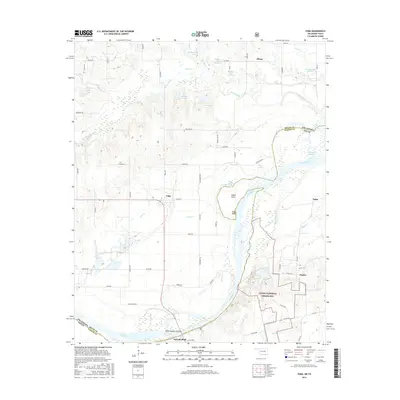
2016 Map of Yuba
USGS Topo · Published 2016About this map
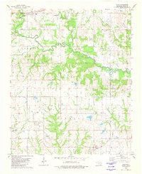
The Red River carves a sinuous path through this borderland region, defining the boundary between Oklahoma and Texas. On the Texas side, the Caddo National Grassland encompasses significant acreage, providing a preserved landscape surrounding the waters of Lake Fannin. Small rural communities such as Yuba, Tulip, and Duplex dot the terrain, connected by a network of local routes like Mackberry Rd and Red Lake Rd. The Oklahoma side in Bryan County is characterized by a high density of water bodies, including Island Bayou, Shellenburger Lake, and several reservoirs like W L Rains Reservoir. Along the river banks, features such as Sowells Bluff and Popes Point mark the shifting riparian landscape. This survey illustrates the intricate drainage patterns of the region, where numerous creeks like Peppercamp Cr and Brown Cr feed into the river system, supporting the local agricultural and timber interests typical of this cross-border environment.
Find a feature on this map
71 named features on this map. Tap any name to fly to it.
Don’t see what you’re looking for? This feature index may not catch every label — zoom into the map to look around manually.
Map Details
Editions of this 2016 Yuba Map
This is the sole edition of this map. No revisions or reprints were ever made.
Other maps of this area

1954 · Sherman
USGS Topo · 1:250,000

1957 · Wade
USGS Topo · 1:62,500

1958 · Durant
USGS Topo · 1:62,500

1958 · Bonham
USGS Topo · 1:62,500

1958 · Whitesright
USGS Topo · 1:62,500

1958 · Sherman
USGS Topo · 1:250,000
1980 · Telephone
USGS Topo · 1:24,000
1980 · Roberta
USGS Topo · 1:24,000
1980 · Bennington South
USGS Topo · 1:24,000
1980 · Blue
USGS Topo · 1:24,000