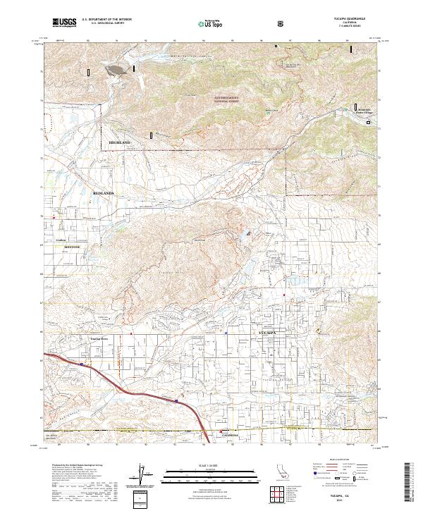
2021 Map of Yucaipa
USGS Topo · Published 2021About this map
The San Bernardino Mountains and the San Bernardino National Forest dominate the northern landscape of this map, giving way to the urban development of Yucaipa and Calimesa to the south. Significant water management infrastructure is visible throughout the terrain, including the historic The Zanja and the Redlands Aqueduct. These systems, along with the Bear Valley High Line Aqueduct, trace the historical effort to divert water from the Santa Ana River and Mill Creek to support the citrus groves and expanding settlements of Redlands and Mentone.
Find a feature on this map
76 named features on this map. Tap any name to fly to it.
Don’t see what you’re looking for? This feature index may not catch every label — zoom into the map to look around manually.
Map Details
Editions of this 2021 Yucaipa Map
This is the sole edition of this map. No revisions or reprints were ever made.
Historical Maps of Dunlap Acres Through Time
4 maps found