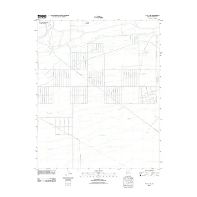
2011 Map of Yucca SE
USGS Topo · Published 2011About this map
The Yucca Ford Automotive Proving Grounds occupies the northwestern corner of this Mojave Desert landscape, marking a shift toward industrial utility in a region defined by its complex drainage network. The terrain is dominated by a series of parallel washes, including Mackenzie Wash, Happy Jack Wash, and Bar L-L Wash, which descend from higher ground toward the southwest. Evidence of the area's mining history is preserved in names like Boriana Mine Rd, which cuts across the northern slopes near Cactus Mountain. South of the proving grounds, a grid of desert roads like Rainbow Rd, Allison Dr, and Dateland Rd suggests a planned settlement or land-use pattern that contrasts with the natural flows of Flattop Wash and Illavar Wash. Isolated water sources such as End Spring and Flat Top Tank provide critical reference points in the arid expanse near the landform simply labeled Flattop.
Find a feature on this map
81 named features on this map. Tap any name to fly to it.
Don’t see what you’re looking for? This feature index may not catch every label — zoom into the map to look around manually.
Map Details
Editions of this 2011 Yucca SE Map
This is the sole edition of this map. No revisions or reprints were ever made.
Other maps of this area

1923 · Signal
USGS Topo · 1:250,000

1927 · Yucca
USGS Topo · 1:62,500

1927 · Buck Mountains
USGS Topo · 1:62,500

1929 · Buck Mountains
USGS Topo · 1:62,500

1929 · Yucca
USGS Topo · 1:62,500

1942 · Signal
USGS Topo · 1:250,000

1950 · Prescott
USGS Topo · 1:250,000

1954 · Needles
USGS Topo · 1:250,000

1954 · Prescott
USGS Topo · 1:250,000

1956 · Needles
USGS Topo · 1:250,000