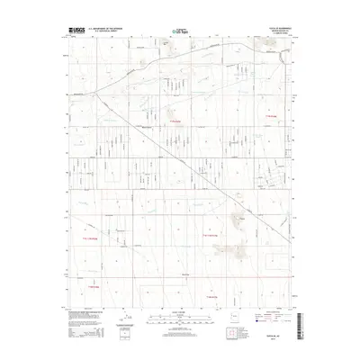
2014 Map of Yucca SE
USGS Topo · Published 2014About this map
Boriana Mine Rd winds across the northern reaches of this landscape, tracing the transition from the arid expanse of Dutch Flat toward the higher elevations of Cactus Mtn. The terrain is defined by an intricate network of seasonal drainages, including Mackenzie Wash and Happy Jack Wash, which originate in the rugged northeastern highlands and descend into the open Mojave Desert. This network suggests a land shaped by flash flooding and ephemeral water sources, reinforced by the presence of End Spring and Flat Top Tank. Sparse road networks like Alamo Rd and Allison Dr crisscross the central desert, providing access to remote survey sections and named landmarks like the elevated Flattop. The grid-like street layout appearing in the center-west portion reflects mid-century desert subdivision attempts, while the remainder of the territory remains largely dominated by the natural features of the Illavar Wash drainage system.
Find a feature on this map
110 named features on this map. Tap any name to fly to it.
Don’t see what you’re looking for? This feature index may not catch every label — zoom into the map to look around manually.
Map Details
Editions of this 2014 Yucca SE Map
This is the sole edition of this map. No revisions or reprints were ever made.
Other maps of this area

1923 · Signal
USGS Topo · 1:250,000

1927 · Yucca
USGS Topo · 1:62,500

1927 · Buck Mountains
USGS Topo · 1:62,500

1929 · Buck Mountains
USGS Topo · 1:62,500

1929 · Yucca
USGS Topo · 1:62,500

1942 · Signal
USGS Topo · 1:250,000

1950 · Prescott
USGS Topo · 1:250,000

1954 · Needles
USGS Topo · 1:250,000

1954 · Prescott
USGS Topo · 1:250,000

1956 · Needles
USGS Topo · 1:250,000