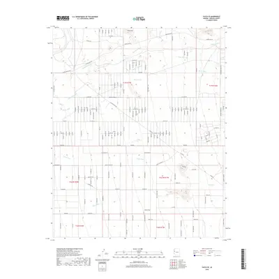
2018 Map of Yucca SE
USGS Topo · Published 2018About this map
Cactus Mtn rises above the arid expanse of the Mojave Desert in this 2018 survey of Mohave County. The landscape is defined by a network of seasonal drainage channels, including the prominent Mackenzie Wash, Happy Jack Wash, and Bar I-L Wash, which illustrate the natural watershed patterns of the high desert. Local ranching and mining history are evidenced by the naming of thoroughfares such as Boriana Mine Rd and Santa Fe Ranch Rd.
Find a feature on this map
39 named features on this map. Tap any name to fly to it.
Don’t see what you’re looking for? This feature index may not catch every label — zoom into the map to look around manually.
Map Details
Editions of this 2018 Yucca SE Map
This is the sole edition of this map. No revisions or reprints were ever made.
Other maps of this area

1923 · Signal
USGS Topo · 1:250,000

1927 · Yucca
USGS Topo · 1:62,500

1927 · Buck Mountains
USGS Topo · 1:62,500

1929 · Buck Mountains
USGS Topo · 1:62,500

1929 · Yucca
USGS Topo · 1:62,500

1942 · Signal
USGS Topo · 1:250,000

1950 · Prescott
USGS Topo · 1:250,000

1954 · Needles
USGS Topo · 1:250,000

1954 · Prescott
USGS Topo · 1:250,000

1956 · Needles
USGS Topo · 1:250,000