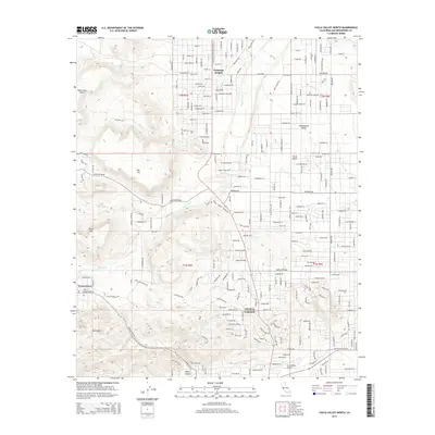
2015 Map of Yucca Valley North
USGS Topo · Published 2015About this map
Yucca Valley serves as the focal point of this high-desert landscape, where the residential grids of the mid-2010s meet the distinct topography of the San Bernardino County interior. To the west, the uniquely named Pioneertown sits among the elevated terrain of the Sawtooths and Black Hill, reflecting the area's history of specialized settlement and filmmaking lore. The map illustrates a transitional desert environment where drainage systems like Pipes Wash and Chaparrosa Wash weave through a network of rural communities, including Flamingo Heights and Homestead Valley. Significant geological markers, such as the Black Lava Butte and the broad plateau of Flat Top, stand in contrast to the increasingly dense street networks of Yucca Mesa. Transportation and local infrastructure are represented by the Yucca Valley Airport and a complex web of named desert roads, showing the extent of modern habitation across the basins and foothills.
Find a feature on this map
200 named features on this map. Tap any name to fly to it.
Don’t see what you’re looking for? This feature index may not catch every label — zoom into the map to look around manually.
Map Details
Editions of this 2015 Yucca Valley North Map
This is the sole edition of this map. No revisions or reprints were ever made.
Other maps of this area

1901 · Southern California Sheet No. 1
USGS Topo · 1:250,000

1902 · San Gorgonio
USGS Topo · 1:125,000

1904 · Southern California Sheet No. 1
USGS Topo · 1:250,000

1953 · San Bernardino
USGS Topo · 1:250,000

1955 · Goat Mountain
USGS Topo · 1:24,000

1955 · Old Woman Springs
USGS Topo · 1:62,500

1955 · Emerson Lake
USGS Topo · 1:62,500

1955 · Morongo Valley
USGS Topo · 1:62,500

1955 · Joshua Tree
USGS Topo · 1:62,500

1956 · San Bernardino
USGS Topo · 1:250,000