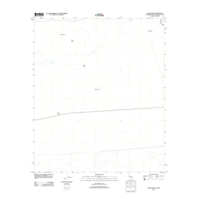
2012 Map of Yuha Basin
USGS Topo · Published 2012About this map
Yuha Desert dominates this arid landscape along the international border, where the drainage of Yuha Wash carves through the basin floor. The terrain is defined by geological and fossil-rich landmarks, including the notable Shell Beds and prominent rises like Yuha Buttes and Sunrise Butte. To the northeast, the land transitions into the elevated West Mesa. This 2012 survey by the U.S. Geological Survey captures the geography of the Yuha Basin, a region characterized by its stark natural features and historical importance as an overland corridor. The map highlights the sparse distribution of named points in this desert environment, focusing on the essential watercourses and topographical heights that have guided travelers through this borderland for generations.
Find a feature on this map
7 named features on this map. Tap any name to fly to it.
Don’t see what you’re looking for? This feature index may not catch every label — zoom into the map to look around manually.
Map Details
Editions of this 2012 Yuha Basin Map
This is the sole edition of this map. No revisions or reprints were ever made.
Other maps of this area

1915 · El Centro
USGS Topo · 1:125,000

1940 · Brawley
USGS Topo · 1:62,500

1940 · Heber
USGS Topo · 1:62,500

1940 · Plaster City
USGS Topo · 1:62,500

1940 · Coyote Wells
USGS Topo · 1:62,500

1942 · El Centro
USGS Topo · 1:250,000

1943 · Coyote Wells
USGS Topo · 1:62,500

1943 · Heber
USGS Topo · 1:62,500

1943 · Brawley
USGS Topo · 1:62,500

1944 · Plaster City
USGS Topo · 1:62,500