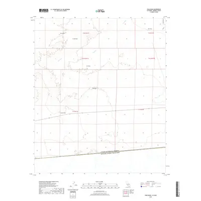
2018 Map of Yuha Basin
USGS Topo · Published 2018About this map
Yuha Basin dominates this arid landscape at the edge of the international border between the United States and Mexico. The terrain is characterized by ancient geology, most notably the Shell Beds and prominent volcanic features like Yuha Buttes and Sunrise Butte that rise from the desert floor. This 2018 survey reveals a largely unpopulated expanse where natural drainage patterns like Yuha Wash define the hydrology of the Yuha Desert. Human impact is minimal, primarily confined to the northeast corner near West Mesa where Mandarin Rd and Hyde Rd provide the only significant road access. The map serves as a detailed record of the border interface, where the topographical features of California meet the limits of the United States of America Estados Unidos Mexicanos.
Find a feature on this map
16 named features on this map. Tap any name to fly to it.
Don’t see what you’re looking for? This feature index may not catch every label — zoom into the map to look around manually.
Map Details
Editions of this 2018 Yuha Basin Map
This is the sole edition of this map. No revisions or reprints were ever made.
Other maps of this area

1915 · El Centro
USGS Topo · 1:125,000

1940 · Brawley
USGS Topo · 1:62,500

1940 · Heber
USGS Topo · 1:62,500

1940 · Plaster City
USGS Topo · 1:62,500

1940 · Coyote Wells
USGS Topo · 1:62,500

1942 · El Centro
USGS Topo · 1:250,000

1943 · Coyote Wells
USGS Topo · 1:62,500

1943 · Heber
USGS Topo · 1:62,500

1943 · Brawley
USGS Topo · 1:62,500

1944 · Plaster City
USGS Topo · 1:62,500