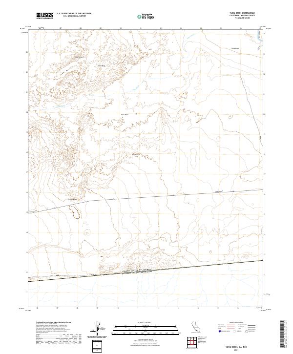
2021 Map of Yuha Basin
USGS Topo · Published 2021About this map
The international border between the United States of America and Mexico anchors the southern edge of this Imperial County landscape. Centered on the depressions of the Yuha Basin, the map details a stark desert environment defined by expansive drainage systems like Yuha Wash. Geologic and topographic landmarks such as Sunrise Butte, the Yuha Buttes, and the fossil-bearing Shell Beds provide points of reference across the Yuha Desert. Human impact is limited to the northern periphery near West Mesa, where Hyde Rd and Mandrapa Rd connect to the local network. The Yuha Cutoff bisects the terrain, illustrating the historical importance of transit corridors through this arid region just north of the border line.
Find a feature on this map
17 named features on this map. Tap any name to fly to it.
Don’t see what you’re looking for? This feature index may not catch every label — zoom into the map to look around manually.
Map Details
Editions of this 2021 Yuha Basin Map
This is the sole edition of this map. No revisions or reprints were ever made.
Other maps of this area

1915 · El Centro
USGS Topo · 1:125,000

1940 · Brawley
USGS Topo · 1:62,500

1940 · Heber
USGS Topo · 1:62,500

1940 · Plaster City
USGS Topo · 1:62,500

1940 · Coyote Wells
USGS Topo · 1:62,500

1942 · El Centro
USGS Topo · 1:250,000

1943 · Coyote Wells
USGS Topo · 1:62,500

1943 · Heber
USGS Topo · 1:62,500

1943 · Brawley
USGS Topo · 1:62,500

1944 · Plaster City
USGS Topo · 1:62,500