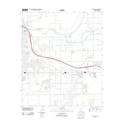
2011 Map of Yuma East
USGS Topo · Published 2011About this map
Prison Hill stands at the confluence of the Colorado River and the Gila River, marking a historic gateway where the city of Yuma transitions into the fertile agricultural lands of the South Gila Valley and North Gila Valley. This 2011 survey documents a landscape defined by intensive irrigation and transit, with the Yuma Main Canal and Canal B 5.5 E feeding the surrounding desert fields. The map captures the significant footprint of the Yuma International Airport and the Yuma County Fairgrounds, reflecting the city's role as a regional hub. Local cultural landmarks like the J C Silver Spur Rodeo Grounds and expansive burial sites including Yuma Cemetery and Desert Lawn Memorial Park provide deep detail for genealogists. The grid of Yuma Mesa shows the steady residential expansion southward, while smaller settlements such as Araby and Patio anchor the eastern and western peripheries.
Find a feature on this map
105 named features on this map. Tap any name to fly to it.
Don’t see what you’re looking for? This feature index may not catch every label — zoom into the map to look around manually.
Map Details
Editions of this 2011 Yuma East Map
This is the sole edition of this map. No revisions or reprints were ever made.
Other maps of this area

1903 · Yuma
USGS Topo · 1:125,000

1905 · Yuma
USGS Topo · 1:125,000

1926 · Fortuna
USGS Topo · 1:62,500

1929 · Fortuna
USGS Topo · 1:62,500

1929 · Laguna
USGS Topo · 1:62,500

1940 · Yuma
USGS Topo · 1:62,500

1942 · Yuma
USGS Topo · 1:250,000

1943 · Laguna
USGS Topo · 1:62,500

1945 · Picacho Peak
USGS Topo · 1:62,500

1945 · Yuma
USGS Topo · 1:62,500