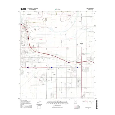
2014 Map of Yuma East
USGS Topo · Published 2014About this map
Yuma sits at a critical geographic junction where the Colorado River and Gila River converge near the California and Arizona border. The landscape is defined by the intricate irrigation network essential to the region, featuring the Yuma Main Canal, S Gila Valley Main Canal, and numerous lateral branches like the B 3.7 Lateral that carve through the South Gila Valley. This 2014 survey documents the modern footprint of the Yuma Marine Corps Air Station/Yuma International Airport, which occupies a significant portion of the southern quadrant near Yuma Mesa. Landmarks such as Prison Hill and Yuma Mineral Spring provide historical context to the river’s edge, while the city's growth is mapped through neighborhoods like El Prado Estates and Araby, alongside the Yuma City Cem and Desert Lawn Memorial Park.
Find a feature on this map
175 named features on this map. Tap any name to fly to it.
Don’t see what you’re looking for? This feature index may not catch every label — zoom into the map to look around manually.
Map Details
Editions of this 2014 Yuma East Map
This is the sole edition of this map. No revisions or reprints were ever made.
Other maps of this area

1903 · Yuma
USGS Topo · 1:125,000

1905 · Yuma
USGS Topo · 1:125,000

1926 · Fortuna
USGS Topo · 1:62,500

1929 · Fortuna
USGS Topo · 1:62,500

1929 · Laguna
USGS Topo · 1:62,500

1940 · Yuma
USGS Topo · 1:62,500

1942 · Yuma
USGS Topo · 1:250,000

1943 · Laguna
USGS Topo · 1:62,500

1945 · Picacho Peak
USGS Topo · 1:62,500

1945 · Yuma
USGS Topo · 1:62,500