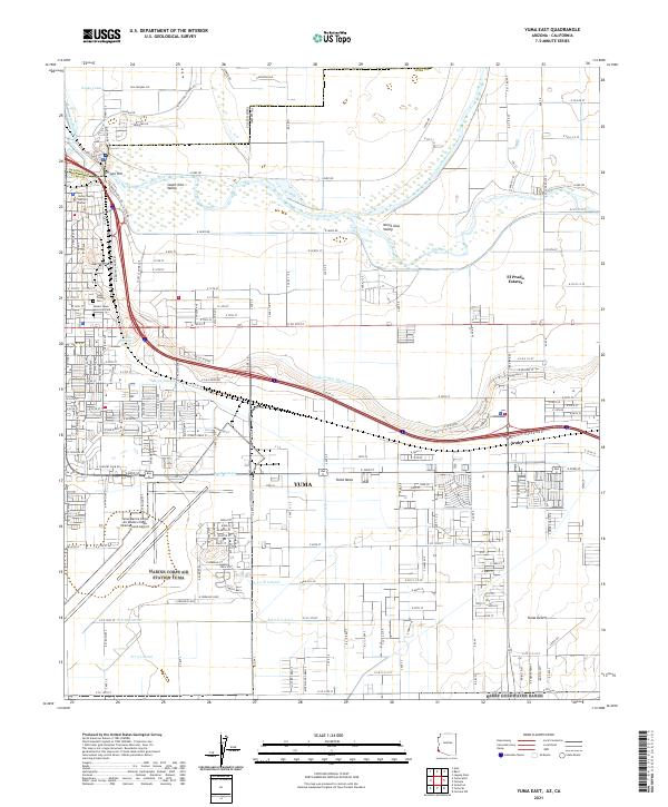
2021 Map of Yuma East
USGS Topo · Published 2021About this map
Prison Hill and the historical crossing of the Colorado River define the northern limits of this modern-day border region. The landscape reflects a complex transition from the river-fed agricultural lands of the South Gila Valley and North Gila Valley to the elevated, arid expanse of the Yuma Mesa and the Yuma Desert. The map documents the city's significant expansion eastward, with residential developments like Sierra Prieta and El Prado Estates contrasting with the vast footprint of the Yuma Marine Corps Air Station/Yuma International Airport.
Find a feature on this map
182 named features on this map. Tap any name to fly to it.
Don’t see what you’re looking for? This feature index may not catch every label — zoom into the map to look around manually.
Map Details
Editions of this 2021 Yuma East Map
This is the sole edition of this map. No revisions or reprints were ever made.
Other maps of this area

1903 · Yuma
USGS Topo · 1:125,000

1905 · Yuma
USGS Topo · 1:125,000

1926 · Fortuna
USGS Topo · 1:62,500

1929 · Fortuna
USGS Topo · 1:62,500

1929 · Laguna
USGS Topo · 1:62,500

1940 · Yuma
USGS Topo · 1:62,500

1942 · Yuma
USGS Topo · 1:250,000

1943 · Laguna
USGS Topo · 1:62,500

1945 · Picacho Peak
USGS Topo · 1:62,500

1945 · Yuma
USGS Topo · 1:62,500