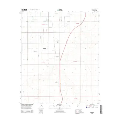
2014 Map of Yuma SE
USGS Topo · Published 2014About this map
Agricultural irrigation networks and the expanding southeastern edge of Yuma characterize this 2014 survey. The landscape is sharply divided between the engineered water systems of the Gila Valley and the arid expanse of the Yuma Desert. To the north and west, a dense grid of laterals—including B Main Lateral, A 8.4 Lateral, and A 9.4 Lateral—feeds the local farm tracts, reflecting the region's total reliance on the A Canal for desert cultivation. Residential growth is evident near Del Pueblo Park and along streets like Verbena St, while the Az-195 highway cuts a prominent path southward through the terrain. Small-scale industrial presence is noted at the Kofa Co-Op, marking a point of intersection between the area's agricultural roots and modern infrastructure developments.
Find a feature on this map
43 named features on this map. Tap any name to fly to it.
Don’t see what you’re looking for? This feature index may not catch every label — zoom into the map to look around manually.
Map Details
Editions of this 2014 Yuma SE Map
This is the sole edition of this map. No revisions or reprints were ever made.
Other maps of this area

1903 · Yuma
USGS Topo · 1:125,000

1905 · Yuma
USGS Topo · 1:125,000

1926 · Fortuna
USGS Topo · 1:62,500

1929 · Fortuna
USGS Topo · 1:62,500

1940 · Yuma
USGS Topo · 1:62,500

1942 · Yuma
USGS Topo · 1:250,000

1945 · Yuma
USGS Topo · 1:62,500

1952 · Yuma East
USGS Topo · 1:24,000

1952 · Yuma West
USGS Topo · 1:24,000

1954 · El Centro
USGS Topo · 1:250,000