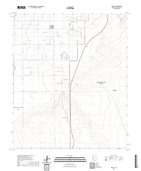
2021 Map of Yuma SE
USGS Topo · Published 2021About this map
Agricultural irrigation infrastructure dominates this corner of Yuma County, where a complex network of channels including the A Canal and B Main Lateral supports the local landscape. The map reveals the rigid grid of the American West, defined by numbered roads like E Co 14 1/2 St and E Co 19th St that intersect with lateral water lines such as the A 8.4 Lateral. To the east, the structured farmland gives way to the expansive Yuma Desert, illustrating the stark boundary between managed irrigation and the natural arid environment. This 2021 survey provides researchers with a modern view of the persistent intersection between large-scale water engineering and desert geography southeast of Yuma.
Find a feature on this map
29 named features on this map. Tap any name to fly to it.
Don’t see what you’re looking for? This feature index may not catch every label — zoom into the map to look around manually.
Map Details
Editions of this 2021 Yuma SE Map
This is the sole edition of this map. No revisions or reprints were ever made.
Other maps of this area

1903 · Yuma
USGS Topo · 1:125,000

1905 · Yuma
USGS Topo · 1:125,000

1926 · Fortuna
USGS Topo · 1:62,500

1929 · Fortuna
USGS Topo · 1:62,500

1940 · Yuma
USGS Topo · 1:62,500

1942 · Yuma
USGS Topo · 1:250,000

1945 · Yuma
USGS Topo · 1:62,500

1952 · Yuma East
USGS Topo · 1:24,000

1952 · Yuma West
USGS Topo · 1:24,000

1954 · El Centro
USGS Topo · 1:250,000