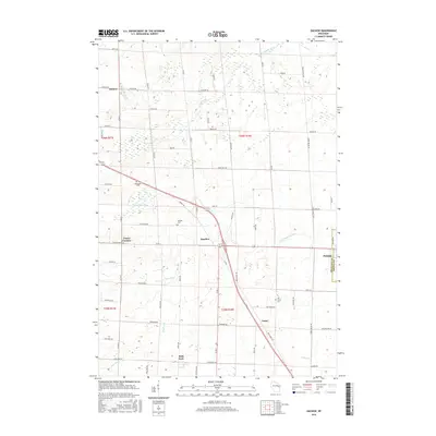
2016 Map of Zachow
USGS Topo · Published 2016About this map
Pulaski serves as a prominent anchor on the eastern edge of this landscape, where the Shawano Co Brown Co line bisects the community. The area is defined by a dense network of rural corridors, including Co Rd C and Co Rd S, which connect a series of small agricultural settlements. Small-town hubs like Angelica and Laney are interspersed among the headwaters of several regional waterways, including the Little Suamico River and Pensaukee River. Local history is preserved in several rural burial grounds such as Hillside Cem and Elm Grove Cem. To the west, the landscape transitions through Frazer Corners toward the village of Zachow. The terrain is characterized by intricate hydrography, with the E Br Shioc River and Black Cr meandering through the southern sections of the quadrangle near Hofa Park.
Find a feature on this map
64 named features on this map. Tap any name to fly to it.
Don’t see what you’re looking for? This feature index may not catch every label — zoom into the map to look around manually.
Map Details
Editions of this 2016 Zachow Map
This is the sole edition of this map. No revisions or reprints were ever made.
Other maps of this area

1954 · Green Bay
USGS Topo · 1:62,500

1955 · Seymour
USGS Topo · 1:62,500

1955 · Green Bay
USGS Topo · 1:250,000

1956 · Gillett
USGS Topo · 1:62,500

1956 · Oconto Falls
USGS Topo · 1:62,500

1974 · Seymour
USGS Topo · 1:24,000

1974 · Cecil
USGS Topo · 1:24,000

1974 · Zachow
USGS Topo · 1:24,000
1974 · Bonduel
USGS Topo · 1:24,000
1974 · Nichols
USGS Topo · 1:24,000