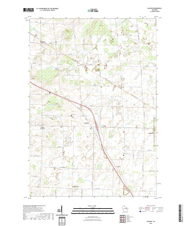
2022 Map of Zachow
USGS Topo · Published 2022About this map
Zachow serves as a central hub in this section of Shawano County, where a network of rural roads like Zachow Rd and Co Rd C connects several small agricultural settlements. The landscape is defined by the drainage patterns of the Pensaukee River in the north and the Little Suamico River to the east, with numerous wetlands interspersed between farmsteads. The Mountain-Bay State Trail cuts diagonally across the terrain, following a corridor that once supported the region's early transportation needs.
Find a feature on this map
65 named features on this map. Tap any name to fly to it.
Don’t see what you’re looking for? This feature index may not catch every label — zoom into the map to look around manually.
Map Details
Editions of this 2022 Zachow Map
This is the sole edition of this map. No revisions or reprints were ever made.
Other maps of this area

1954 · Green Bay
USGS Topo · 1:62,500

1955 · Seymour
USGS Topo · 1:62,500

1955 · Green Bay
USGS Topo · 1:250,000

1956 · Gillett
USGS Topo · 1:62,500

1956 · Oconto Falls
USGS Topo · 1:62,500

1974 · Seymour
USGS Topo · 1:24,000

1974 · Cecil
USGS Topo · 1:24,000

1974 · Zachow
USGS Topo · 1:24,000
1974 · Bonduel
USGS Topo · 1:24,000
1974 · Nichols
USGS Topo · 1:24,000