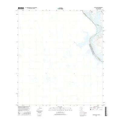
2016 Map of Zapata NW
USGS Topo · Published 2016About this map
The Rio Grande serves as the defining international boundary in this part of South Texas, separating Zapata County from the United Mexican States. This landscape is heavily influenced by the northern reaches of the Falcon Reservoir, where the fluctuating waterline of the Rio Grande creates a shifting riparian environment along the border. Local history is anchored by the presence of the Old Raotireno Cemetery in the northeastern corner of the map, a significant site for genealogical research in this sparsely populated region. The topography is characterized by the arid drainage systems and scrubland typical of the Rio Grande Valley before it descends into the reservoir’s basin.
Find a feature on this map
6 named features on this map. Tap any name to fly to it.
Don’t see what you’re looking for? This feature index may not catch every label — zoom into the map to look around manually.
Map Details
Editions of this 2016 Zapata NW Map
This is the sole edition of this map. No revisions or reprints were ever made.
Other maps of this area

1942 · San Ygnacio
USGS Topo · 1:62,500

1949 · Mc Allen
USGS Topo · 1:250,000

1954 · McAllen
USGS Topo · 1:250,000

1956 · Zapata
USGS Topo · 1:62,500

1956 · Laredo
USGS Topo · 1:250,000

1957 · Mc Allen
USGS Topo · 1:250,000

1962 · McAllen
USGS Topo · 1:250,000
1979 · Zapata
USGS Topo · 1:24,000
1979 · Zapata SE
USGS Topo · 1:24,000
1979 · Zapata NW
USGS Topo · 1:24,000