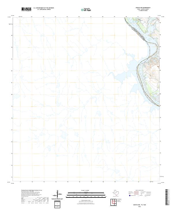
2022 Map of Zapata NW
USGS Topo · Published 2022About this map
The Rio Grande marks the international boundary between the United States and Mexico in this corner of South Texas. This specific section of the border is defined by the expansive Falcon Reservoir, which submerged much of the traditional riverbank landscape when it was created. Historical traces remain on the Texas side, most notably the Old Ramireno Cem, a site of significant genealogical value for families with roots in the Zapata County area. The surrounding terrain is characterized by the dendritic drainage patterns of small, unnamed arroyos that feed into the reservoir, reflecting the arid brushland that historically supported ranching communities along the river's edge.
Find a feature on this map
4 named features on this map. Tap any name to fly to it.
Don’t see what you’re looking for? This feature index may not catch every label — zoom into the map to look around manually.
Map Details
Editions of this 2022 Zapata NW Map
This is the sole edition of this map. No revisions or reprints were ever made.
Other maps of this area

1942 · San Ygnacio
USGS Topo · 1:62,500

1949 · Mc Allen
USGS Topo · 1:250,000

1954 · McAllen
USGS Topo · 1:250,000

1956 · Zapata
USGS Topo · 1:62,500

1956 · Laredo
USGS Topo · 1:250,000

1957 · Mc Allen
USGS Topo · 1:250,000

1962 · McAllen
USGS Topo · 1:250,000
1979 · Zapata
USGS Topo · 1:24,000
1979 · Zapata SE
USGS Topo · 1:24,000
1979 · Zapata NW
USGS Topo · 1:24,000