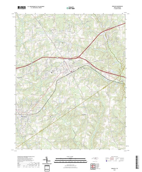
2022 Map of Zebulon
USGS Topo · Published 2022About this map
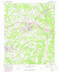
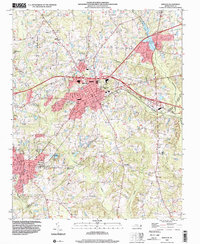
Zebulon and Wendell anchor the eastern reaches of the Research Triangle area in this modern topographic survey, which highlights the intersection of growing suburban corridors and rural traditions. The map traces the transition from the organized grid of Wendell to the sprawling outskirts of Zebulon, including the curious locality of Lizard Lick. This area is defined by its complex hydrology, where Moccasin Creek and Little River wind through the landscape, feeding numerous private and agricultural water bodies like Privette Lake Number One and Ammons Pond.
Find a feature on this map
168 named features on this map. Tap any name to fly to it.
Don’t see what you’re looking for? This feature index may not catch every label — zoom into the map to look around manually.
Map Details
Editions of this 2022 Zebulon Map
This is the sole edition of this map. No revisions or reprints were ever made.