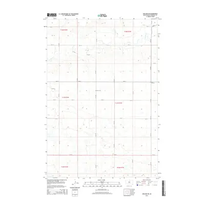
2015 Map of Zeeland SW
USGS Topo · Published 2015About this map
Spring Creek meanders through this portion of Campbell County, cutting across the section lines of the Public Land Survey System in a landscape otherwise defined by a rigid grid of rural roads. The area represents a sparsely populated agricultural environment in the 2010s, where movement is dictated by routes such as 108th St and 312th Ave. Genealogical interest is centered on two distinct burial sites: Reformed Cemetery near the center of the sheet and Spring Creek Cemetery further to the northeast. These small, isolated cemeteries serve as the primary markers of the local community's heritage in an era of large-scale farming and open prairie.
Find a feature on this map
19 named features on this map. Tap any name to fly to it.
Don’t see what you’re looking for? This feature index may not catch every label — zoom into the map to look around manually.
Map Details
Editions of this 2015 Zeeland SW Map
This is the sole edition of this map. No revisions or reprints were ever made.
Other maps of this area

1953 · McIntosh
USGS Topo · 1:250,000

1954 · Aberdeen
USGS Topo · 1:250,000

1956 · Aberdeen
USGS Topo · 1:250,000

1958 · McIntosh
USGS Topo · 1:250,000

1965 · Herreid NE
USGS Topo · 1:24,000

1965 · Herreid
USGS Topo · 1:24,000

1967 · Mound City
USGS Topo · 1:24,000

1978 · Salt Lake
USGS Topo · 1:24,000

1978 · Zeeland
USGS Topo · 1:24,000
1978 · Zeeland NW
USGS Topo · 1:24,000