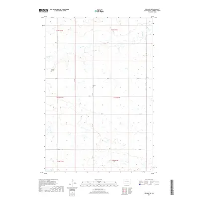
2017 Map of Zeeland SW
USGS Topo · Published 2017About this map
Isolated cemeteries and seasonal watercourses define this rural section of Campbell County along the North Dakota border. The landscape is marked by the meandering path of Spring Creek, which threads through the northern sections alongside local routes such as 105th St and 106th St. For those tracing family histories, the map identifies specific small burial sites including the A C Rossow Farm Cem and the Spring Creek Cem, reflecting the area's agricultural heritage and dispersed settlement patterns. In the southern reaches, Big Lake sits within a network of wetlands that characterize the low-lying prairie terrain. The map's grid of section lines and gravel roads, like 312th Ave, reveals a landscape largely dedicated to farming, punctuated only by the Reformed Cem and the occasional junction of county thoroughfares.
Find a feature on this map
24 named features on this map. Tap any name to fly to it.
Don’t see what you’re looking for? This feature index may not catch every label — zoom into the map to look around manually.
Map Details
Editions of this 2017 Zeeland SW Map
This is the sole edition of this map. No revisions or reprints were ever made.
Other maps of this area

1953 · McIntosh
USGS Topo · 1:250,000

1954 · Aberdeen
USGS Topo · 1:250,000

1956 · Aberdeen
USGS Topo · 1:250,000

1958 · McIntosh
USGS Topo · 1:250,000

1965 · Herreid NE
USGS Topo · 1:24,000

1965 · Herreid
USGS Topo · 1:24,000

1967 · Mound City
USGS Topo · 1:24,000

1978 · Salt Lake
USGS Topo · 1:24,000

1978 · Zeeland
USGS Topo · 1:24,000
1978 · Zeeland NW
USGS Topo · 1:24,000