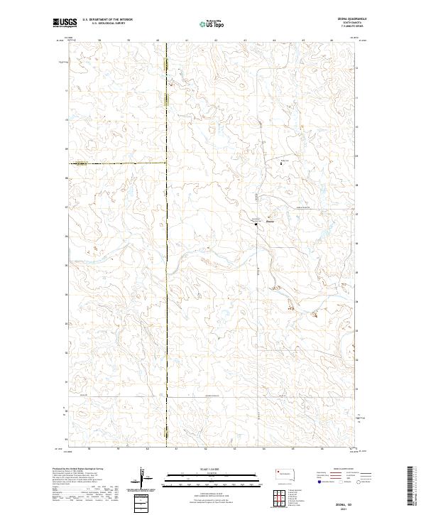
2021 Map of Zeona
USGS Topo · Published 2021About this map
Zeona remains a focal point in this remote section of Perkins County, located near the intersection of Zeona Rd and Moreau River Rd. The landscape is defined by the drainage of the N Fork Moreau River, which meanders through the southwestern portion of the quadrangle. For genealogists and local historians, the presence of the Immanuel Lutheran Cem and Ruby Cem provides vital points of interest for family research in this high-plains region. The map also records the precise tri-county corner where the boundaries of Harding, Butte, and Perkins counties meet. Water resources like Sheep Cr and Ash Cr trace the natural topography, illustrating the drainage patterns that have historically dictated land use and settlement in this corner of South Dakota.
Find a feature on this map
19 named features on this map. Tap any name to fly to it.
Don’t see what you’re looking for? This feature index may not catch every label — zoom into the map to look around manually.
Map Details
Editions of this 2021 Zeona Map
This is the sole edition of this map. No revisions or reprints were ever made.
Other maps of this area

1935 · Hoover
USGS Topo · 1:125,000

1954 · Lemmon
USGS Topo · 1:250,000

1957 · Lemmon
USGS Topo · 1:250,000

1968 · Sheep Mountain
USGS Topo · 1:24,000
1978 · Fish Draw
USGS Topo · 1:24,000
1978 · Tomato Can Buttes
USGS Topo · 1:24,000

1980 · Redig
USGS Topo · 1:100,000

1980 · Beverly Creek
USGS Topo · 1:25,000

1980 · Zeona
USGS Topo · 1:25,000

1983 · Sorum SE
USGS Topo · 1:24,000