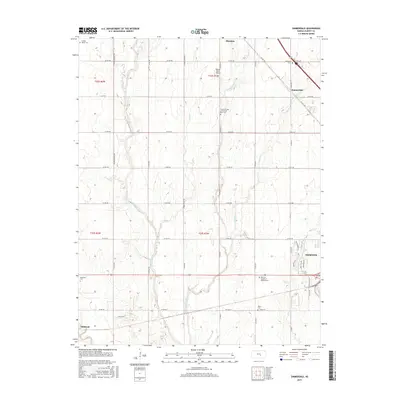
2015 Map of Zimmerdale
USGS Topo · Published 2015About this map
Zimmerdale and Hesston sit atop a landscape defined by the branching tributaries of Emma Creek. This 2015 survey reveals a classic Midwestern township-and-range grid, where family-named landmarks and rural burial grounds reflect generations of local history. Notable sites such as the Church of God of the First Born Cem and the Weaver Ranch Airport are nestled within the agricultural sections, while the southern edge of the map reaches the outskirts of Halstead. The terrain is etched by the meandering paths of W Emma Cr and Middle Emma Cr, showing how water drainage influenced the placement of roads and farmsteads. Genealogists will find a high density of cemetery sites, including Eastlawn Cem, Royer Cem, and the Restlawn Garden of Memory Cem, providing a clear record of local family lineages across Harvey County.
Find a feature on this map
82 named features on this map. Tap any name to fly to it.
Don’t see what you’re looking for? This feature index may not catch every label — zoom into the map to look around manually.
Map Details
Editions of this 2015 Zimmerdale Map
This is the sole edition of this map. No revisions or reprints were ever made.
Other maps of this area

1889 · Newton
USGS Topo · 1:125,000

1889 · Cheney
USGS Topo · 1:125,000

1889 · Wichita
USGS Topo · 1:125,000

1891 · Hutchinson
USGS Topo · 1:125,000

1891 · Cheney
USGS Topo · 1:125,000

1893 · Hutchinson
USGS Topo · 1:125,000

1894 · Wichita
USGS Topo · 1:125,000

1894 · Newton
USGS Topo · 1:125,000

1901 · Cheney
USGS Topo · 1:125,000

1955 · Wichita
USGS Topo · 1:250,000