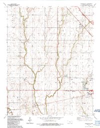
1989 Map of Zimmerdale
USGS Topo · Published 1990About this map
Emma Creek and its many branches, including West Emma Creek, Middle Emma Creek, and East Emma Creek, define the drainage patterns of this Harvey County landscape. The map shows the northern outskirts of Newton and the small settlement of Zimmerdale, situated near a bend in the water and a dedicated Roadside Park. This late-20th-century survey documents a region defined by its agricultural layout and spiritual landmarks, with several family and community burial grounds scattered across the townships of Emma and Macon. Genealogists will find notable value in the precisely marked Church of God Cem, Royer Cem, and the Emma Restlawn Garden of Memory Cem. Along the southern margin, the Arkansas River flows past the Halstead Cem, while local industry is represented by a Gravel Pit and several municipal utilities.
Find a feature on this map
29 named features on this map. Tap any name to fly to it.
Don’t see what you’re looking for? This feature index may not catch every label — zoom into the map to look around manually.
Map Details
Editions of this 1989 Zimmerdale Map
This is the sole edition of this map. No revisions or reprints were ever made.
Other maps of this area

1889 · Newton
USGS Topo · 1:125,000

1889 · Cheney
USGS Topo · 1:125,000

1889 · Wichita
USGS Topo · 1:125,000

1891 · Hutchinson
USGS Topo · 1:125,000

1891 · Cheney
USGS Topo · 1:125,000

1893 · Hutchinson
USGS Topo · 1:125,000

1894 · Wichita
USGS Topo · 1:125,000

1894 · Newton
USGS Topo · 1:125,000

1901 · Cheney
USGS Topo · 1:125,000

1955 · Wichita
USGS Topo · 1:250,000