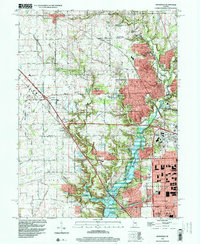
1998 Map of Zionsville
USGS Topo · Published 2001About this map
The Eagle Creek Reservoir and its associated Eagle Creek City Park dominate the landscape of this late-20th-century survey, illustrating the significant hydraulic and recreational infrastructure north of Indianapolis. The map captures a transition from the historic rural character of Worth and Eagle townships toward suburban expansion. In the north, the town of Zionsville is shown alongside the Central Railroad of Indiana, while the western edge reveals the developing intersections near Whitestown. Intermittent remnants of the area's agricultural past are visible in family landmarks like Cox Cem and Pitzer Cem. The dense network of pipelines and major freeway interchanges, including Interchange 130 and Interchange 129, signals the rapid modern transformation of Boone Co and Hendricks Co as they integrate with the state capital's growing footprint.
Find a feature on this map
62 named features on this map. Tap any name to fly to it.
Don’t see what you’re looking for? This feature index may not catch every label — zoom into the map to look around manually.
Map Details
Editions of this 1998 Zionsville Map
This is the sole edition of this map. No revisions or reprints were ever made.
Other maps of this area

1948 · Indianapolis West
USGS Topo · 1:24,000

1952 · Carmel
USGS Topo · 1:24,000

1953 · Westfield
USGS Topo · 1:24,000

1953 · Fayette
USGS Topo · 1:24,000

1953 · Rosston
USGS Topo · 1:24,000

1953 · Brownsburg
USGS Topo · 1:24,000

1953 · Zionsville
USGS Topo · 1:24,000

1953 · Lebanon
USGS Topo · 1:24,000

1953 · Clermont
USGS Topo · 1:24,000

1953 · Danville
USGS Topo · 1:250,000