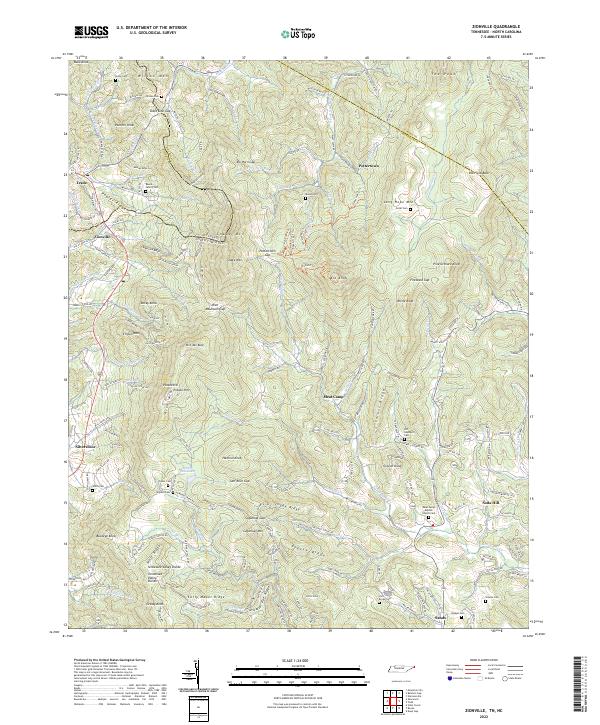
2022 Map of Zionville
USGS Topo · Published 2022About this map
Snake Mtn and Elk Knob dominate the high-elevation divide along the Tennessee and North Carolina state line, where the Appalachian landscape funnels travel through gaps like Pottertown Gap and Rich Mountain Gap. This rugged interior at the edge of the Blue Ridge contains several isolated settlements, including Trade and Zionville, connected by winding routes like Old US Hwy 421. The complex drainage patterns of the N Fork New River and Roan Creek define the agricultural pockets where numerous family burial grounds are located, such as the Reece Family Cem and Wilson Cem. These cemeteries, along with landmarks like the Hopewell Baptist Church Cem in the Meat Camp vicinity, provide significant points of interest for genealogists tracing mountain families. The terrain is further marked by high-altitude features like Potato Hill Lake and the distinctive Old Field Bald.
Find a feature on this map
198 named features on this map. Tap any name to fly to it.
Don’t see what you’re looking for? This feature index may not catch every label — zoom into the map to look around manually.
Map Details
Editions of this 2022 Zionville Map
This is the sole edition of this map. No revisions or reprints were ever made.
Other maps of this area

1893 · Cranberry
USGS Topo · 1:125,000

1895 · Cranberry
USGS Topo · 1:125,000

1899 · Cranberry
USGS Topo · 1:125,000

1902 · Cranberry
USGS Topo · 1:125,000

1934 · Valle Crucis
USGS Topo · 1:24,000

1934 · Boone
USGS Topo · 1:24,000

1935 · Baldwin Gap
USGS Topo · 1:24,000

1935 · Doe Mountain
USGS Topo · 1:48,000

1935 · Sherwood
USGS Topo · 1:24,000

1935 · Zionville
USGS Topo · 1:24,000