
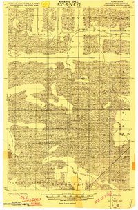
1918 Map of Zora
USGS Topo · Published 1943About this map
The meandering Big Fork River carves through a landscape of heavy wetlands and timber in this early 20th-century survey of the North Woods. Compiled by the Corps of Engineers, the map captures the borderlands of Koochiching and Itasca counties during a period when the region was defined by massive drainage projects and scattered frontier settlements. The presence of the Judicial Ditch and the sparsely populated Caldwell reflect the era's focus on reclaiming the lowlands of Wicker and Wirt for development. Navigation through these dense marshlands relied on the Big Fork River and early overland paths simply labeled as Trail. This document provides a foundational look at the hydrology and early infrastructure of the northern Minnesota wilderness before modern road networks dominated the terrain.
Find a feature on this map
13 named features on this map. Tap any name to fly to it.
Don’t see what you’re looking for? This feature index may not catch every label — zoom into the map to look around manually.
Map Details
Editions of this 1918 Zora Map
This is the sole edition of this map. No revisions or reprints were ever made.
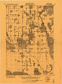
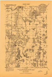
Other maps of this area

1919 · Zora
USGS Topo · 1:62,500
1919 · Lundgren
USGS Topo · 1:62,500

1919 · Gemmell
USGS Topo · 1:62,500
1919 · Max
USGS Topo · 1:62,500
1919 · Marcell
USGS Topo · 1:62,500

1919 · M
USGS Topo · 1:62,500

1919 · Margie
USGS Topo · 1:62,500

1954 · Bemidji
USGS Topo · 1:250,000

1954 · Hibbing
USGS Topo · 1:250,000

1954 · Roseau
USGS Topo · 1:250,000