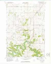
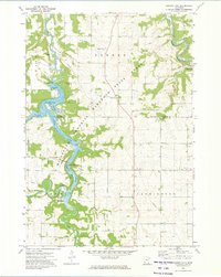
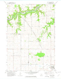
1974 Map of Zumbro Falls
USGS Topo · Published 1976About this map
Zumbro River loops through the heart of this landscape, its sharp meanders defining the topography as it flows toward Zumbro Falls. The river's path is shadowed by the remnants of the Old Railroad Grade, a corridor that once tied these blufflands to the regional economy. Much of the terrain is managed within the Minnesota Memorial Hardwood State Forest, though the presence of numerous family and township burial grounds, such as Black Cem, English Cem, and Bear Valley Cem, speaks to a legacy of multi-generational farming. Small settlements like Oak Center and Mazeppa anchor the agricultural uplands. Beyond the river, the landscape is marked by natural features like Cold Brook Spring and Buckman Coulee, alongside several quarries and gravel pits that suggest the local industries of the mid-1970s.
Find a feature on this map
41 named features on this map. Tap any name to fly to it.
Don’t see what you’re looking for? This feature index may not catch every label — zoom into the map to look around manually.
Map Details
Editions of this 1974 Zumbro Falls Map
This is the sole edition of this map. No revisions or reprints were ever made.
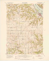
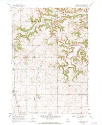
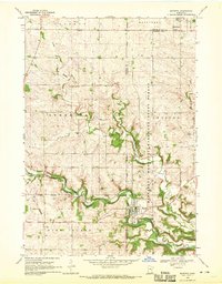
Other maps of this area

1935 · Rochester
USGS Topo · 1:48,000

1939 · Rochester
USGS Topo · 1:62,500
1951 · Lake City
USGS Topo · 1:62,500

1953 · Saint Paul
USGS Topo · 1:250,000

1959 · Saint Paul
USGS Topo · 1:250,000

1965 · Oronoco
USGS Topo · 1:24,000
1968 · Goodhue East
USGS Topo · 1:24,000
1968 · Mazeppa
USGS Topo · 1:24,000
1972 · Zumbro Lake
USGS Topo · 1:24,000
1972 · Millville
USGS Topo · 1:24,000