Old Maps of Rincón for Hiking & Exploration
Hike through history with 25 historic maps of Rincón. Explore old trails, ghost towns, and forgotten backroads — perfect for outdoor adventurers and local explorers.
- Rediscover forgotten places: Map out old mining camps, roads, and footpaths that no longer exist on modern maps.
- Layer with modern tools: Combine with LiDAR or satellite views to plan hikes through historical terrain.
- Made for exploration: Popular among hikers, overlanders, and local history lovers.
Use these maps to find adventure and explore the hidden past of Rincón.
Rincón maps
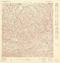
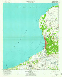
(25)- 1937 Map of Aguadilla
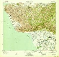
 1937 Aguadilla1937 Print · USGSNorthwestern Puerto Rico during the late 1930s reveals a landscape of coastal settlements and industrial rail lines. Genealogists and historians can trace the foundations of local communities through landmarks like the Iglesia de la Conception and the American railroad route through Coloso.
 - 1941 Map of Rincon
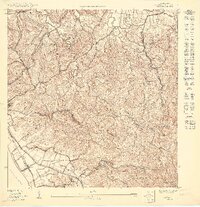
 1941 Rincon1941 Print · USGSCoastal western Puerto Rico in the early 1940s reveals a bustling landscape defined by the sugar industry and the sea. Trace the American Railroad of Puerto Rico as it links Rincón to major mills like Central Igualdad and Central Coloso.
 - 1941 Map of Rincon
 1941 Rincon1941 Print · USGSWestern Puerto Rico’s sugar economy is at its peak in the early 1940s, showing the intricate network of plantations and rails between the coast and the mountains. Genealogists can trace family lands through named estates like Colonia Dolores or follow the American Railroad of Puerto Rico through Añasco.
 - 1942 Map of Aguadilla
 1942 Aguadilla1942 Print · USGSCoastal life in northwest Puerto Rico during the early 1940s centered on the rail lines and rivers of the Aguadilla region. Genealogists and historians can trace family roots through the numerous railroad stops of the American Railroad or locate historical landmarks like the Pta Borinquen L H and the Iglesia Aguadilla.5 unique versions available
 - 1947 Map of Rincon
 1947 Rincon1947 Print · USGSCoastal Puerto Rico in the late 1940s reveals a landscape of sugarcane colonies and coastal railways. Researchers can trace family-named sites like Desvío Santoni, the Estación Añasco rail stop, and agricultural hubs like Colonia Libertad.2 unique versions available
 - 1947 Map of Rincon
 1947 Rincon1947 Print · USGSWestern Puerto Rico is captured here in the late 1930s, showing a landscape defined by the coastal sugar economy and the American RR. Genealogists can trace family locations through named colonias like Colonia Libertad and landmarks such as Central Igualdad.
 - 1949 Map of Rincon, 1952 Print
 1949 Rincon1952 Print · USGSWestern Puerto Rico is captured here in the late 1940s, highlighting the intricate network of sugar colonies and railroads. Genealogists can trace family connections to numerous named estates and landmarks like Colonia Libertad, Hacienda Eugenia, and the Pta Jiguera Lighthouse.2 unique versions available
 - 1950 Map of Rincon ONO
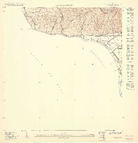
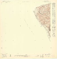 1950 Rincon ONO1950 Print · USGSCoastal Rincón at mid-century reveals a landscape shaped by the rail industry and steep Caribbean topography. Genealogists and historians can trace old homesteads around Centro Puntas and the path of the American RR of Porto Rico as it skirts the shoreline.
 - 1950 Map of Aguadilla SO
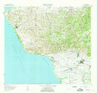
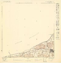 1950 Aguadilla SO1950 Print · USGSAguada at the mid-century reveals a coastal landscape defined by the sugar-hauling American Railroad of Porto Rico and traditional barrios. Researchers can trace the original boundaries of Carrizal and Piedras Blancas or locate the historic Aguada Parada de Colón near the Atlantic shore.
 - 1950 Map of Rincon SE
 1950 Rincon SE1950 Print · USGSThe valley of Añasco was a powerhouse of the sugar industry during the late 1940s, with a dense network of rail lines and industrial centrals. Genealogists can trace family footprints across dozens of named estates like Colonia Pagán and Hacienda Eugenia, or locate the old Estación Añasco.
 - 1950 Map of Rincon NE
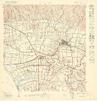
 1950 Rincon NE1950 Print · USGSAguada and the high ridges of northwestern Puerto Rico are captured here at mid-century, before modern development transformed the mountain barrios. Local historians can trace the rural school and chapel network, including Capilla Malpaso and Escuela Segunda Unidad de Guanábano.
 - 1950 Map of Rincon NO
 1950 Rincon NO1950 Print · USGSWestern Puerto Rico is captured here in the mid-century, showing the critical intersection of the coastal railroad and the interior sugar economy. Researchers can trace the path of the American RR past Central Calvache or locate the Escuela Segunda Unidad de Jagüey in the hills.
 - 1950 Map of Rincon SO
 1950 Rincon SO1950 Print · USGSCoastal Añasco and Rincón appear here at the height of the island's rail-and-sugar era. Genealogists and historians can trace the American RR Porto Rico line through industrial landmarks like Hacienda Eugenia and the community at Tres Hermanos.
 - 1955 Map of Rincon, 1958 Print
 1955 Rincon1958 Print · USGSWestern Puerto Rico in the mid-1950s shows a landscape of coastal sugar colonies and steep mountain barrios. Genealogists and historians can trace family locations through numerous named estates like Colonia Pagán, landmark schools, and the Faro at the island's edge.
 - 1960 Map of Aguadilla, 1962 Print
 1960 Aguadilla1962 Print · USGSCoastal Aguadilla and the surrounding municipios are shown during a period of significant growth at the start of the 1960s. Researchers can trace the layout of Ramey Air Force Base, find local landmarks like Colegio San Carlos, or follow the Via Del Ferrocarril through Aguada.5 unique versions available
 - 1966 Map of Rincon, 1969 Print
 1966 Rincon1969 Print · USGSThe western tip of Puerto Rico at the mid-sixties shows a coast in transition between historic agriculture and modern infrastructure. Genealogists and historians can trace numerous rural schools and chapels like Capilla Santa Rita or the operations of the Central Igualdad sugar mill.2 unique versions available
 - 2013 Map of Aguadilla, 2013 Print
 2013 Aguadilla2013 Print · USGSCovers Rincón, including Aguadilla, Aguada, and other nearby areas
 - 2013 Map of Rincon OE W, 2013 Print
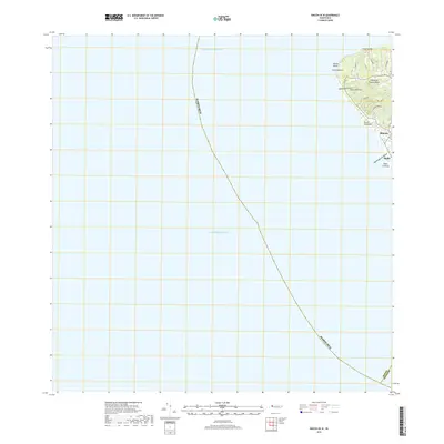
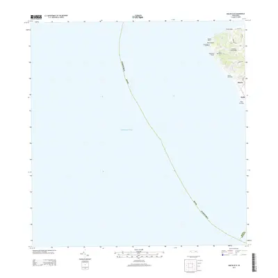 2013 Rincon OE W2013 Print · USGSCovers Rincón, including Puerto Rico, Barrio Pueblo, and other nearby areas
 - 2013 Map of Rincon, 2013 Print
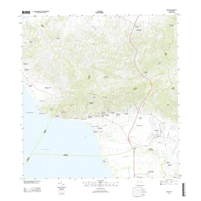 2013 Rincon2013 Print · USGSCovers Rincón, including Añasco, Sector Los Ríos, and other nearby areas
 - 2018 Map of Rincon OE W, 2018 Print
 2018 Rincon OE W2018 Print · USGSCovers Rincón, including Puerto Rico, Barrio Pueblo, and other nearby areas
 - 2018 Map of Rincon, 2018 Print
 2018 Rincon2018 Print · USGSCovers Rincón, including Añasco, Sector Los Ríos, and other nearby areas
 - 2018 Map of Aguadilla, 2018 Print
 2018 Aguadilla2018 Print · USGSCovers Rincón, including Aguadilla, Aguada, and other nearby areas
 - 2024 Map of Rincon OE W, 2024 Print
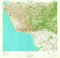
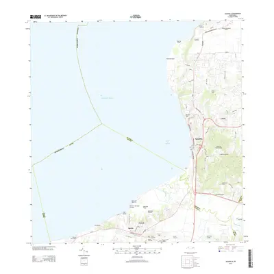
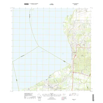
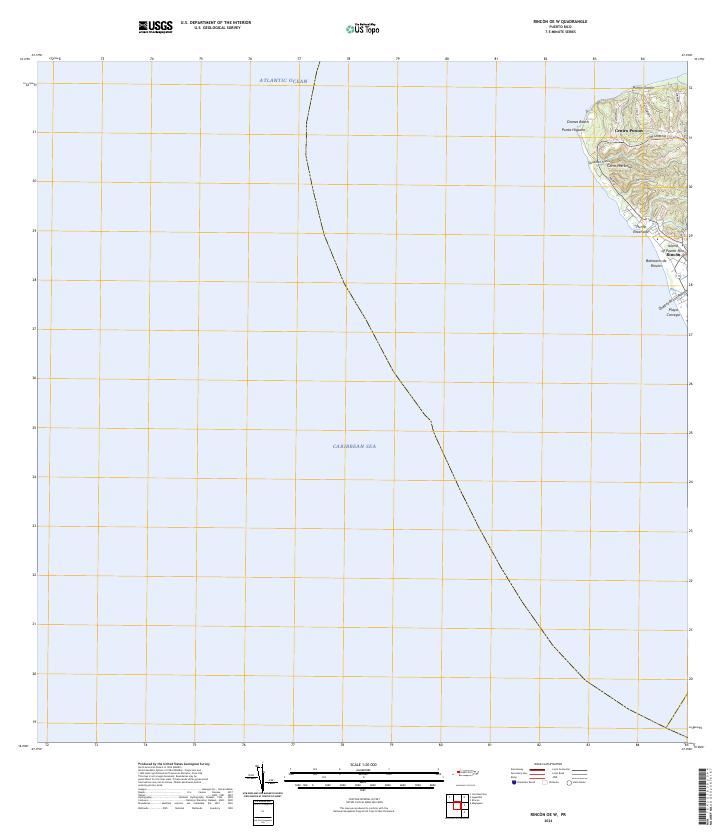 2024 Rincon OE W2024 Print · USGSWestern Puerto Rico is documented here in the early twenty-first century as the coast meets two different seas. Local researchers can trace residential growth and land use around Centro Puntas, Domes Beach, and the inland roads of Cerro Martinica.
 - 2024 Map of Rincon, 2024 Print
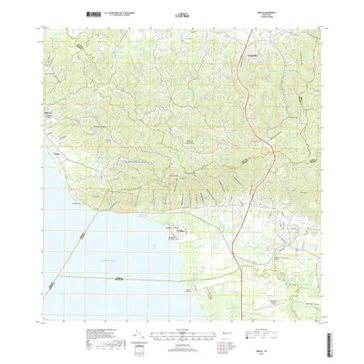
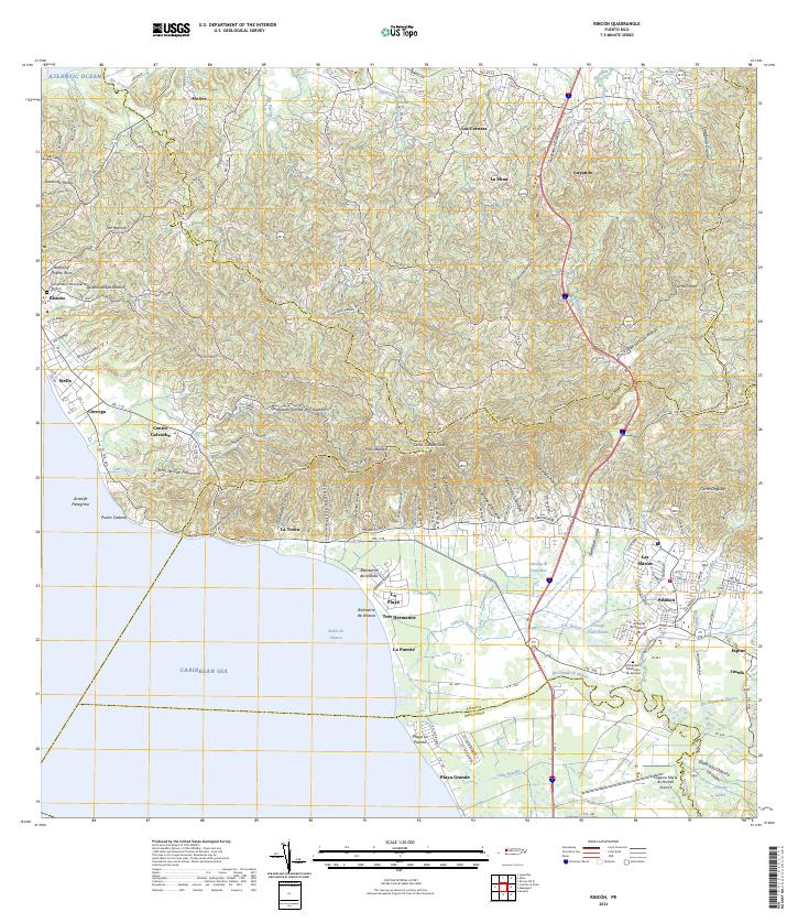 2024 Rincon2024 Print · USGSThe western coast of Puerto Rico is captured here in detail, showing the transition from the rugged hills of La Cadena to the sandy reaches of Playa Grande. Researchers can locate specific family sites near Cementerio Municipal de Añasco or trace the winding path of the Río Grande de Añasco.
 - 2024 Map of Aguadilla, 2024 Print
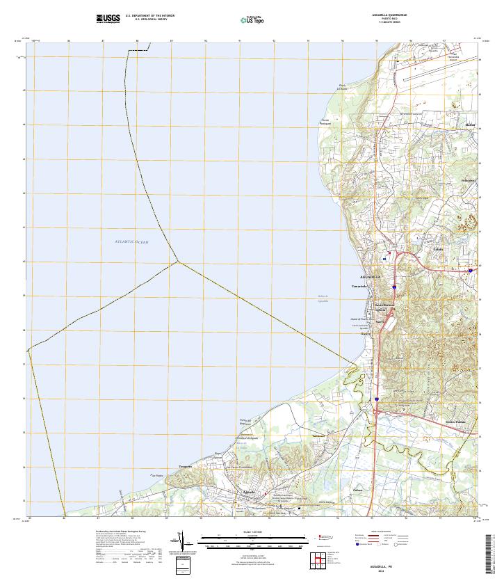 2024 Aguadilla2024 Print · USGSAguadilla and its neighboring coastal settlements are captured here in the early twenty-first century. Researchers can trace family roots at the Cementerio Los Rosales or explore landmarks like the Rafael Hernandez Airport.
End of results
Showing maps 1-25 of 25
Frequently asked questions
- What are the different types of historical maps available for Rincón?
- What is the oldest map of Rincón?
- Where can I purchase historical maps of Rincón for my home or office?
- Where can I download high-res historical maps of Rincón?
- Are there historical topographic maps available for Rincón?
- Is there historical aerial imagery available for Rincón?
- Where are historical maps of Rincón sourced from?