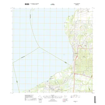
2018 Map of Aguadilla
USGS Topo · Published 2018About this map
The coastal interface of northwest Puerto Rico is defined by the sweeping curve of the Bahía de Aguadilla, where the urban center of Aguadilla transitions into the varied terrain of the Cordillera Jaicoa. This 2018 survey illustrates the modern layout of the region, anchored in the north by the Rafael Hernandez Airport at Punta Borinquen. To the south, the landscape softens into the alluvial plains of the Río Culebrinas, which separates the primary settlements from the residential areas of Aguada and Los Cerros Cusualidad. Historical and cultural sites are well-documented, including the Cementerio Municipal Andres Vargas Caparró De Aguada and Cementerio Los Rosales. The map also captures the intricate drainage system of the area, featuring the Canal Aguadilla and various caños such as Caño Media Luna that once shaped the local agricultural economy.
Find a feature on this map
45 named features on this map. Tap any name to fly to it.
Don’t see what you’re looking for? This feature index may not catch every label — zoom into the map to look around manually.
Map Details
Editions of this 2018 Aguadilla Map
This is the sole edition of this map. No revisions or reprints were ever made.
Other maps of this area

1937 · Aguadilla
USGS Topo · 1:20,000

1937 · Moca
USGS Topo · 1:20,000

1938 · Alto Sano
USGS Topo · 1:20,000

1941 · Moca
USGS Topo · 1:30,000

1941 · Rincon
USGS Topo · 1:30,000

1941 · Rincon
USGS Topo · 1:30,000

1941 · Isabela
USGS Topo · 1:30,000

1942 · Moca
USGS Topo · 1:30,000

1942 · Central La Plata
USGS Topo · 1:30,000

1942 · Aguadilla
USGS Topo · 1:30,000