Old Maps of Fairhope, Alabama for Hiking & Exploration
Hike through history with 42 historic maps of Fairhope. Explore old trails, ghost towns, and forgotten backroads — perfect for outdoor adventurers and local explorers.
- Rediscover forgotten places: Map out old mining camps, roads, and footpaths that no longer exist on modern maps.
- Layer with modern tools: Combine with LiDAR or satellite views to plan hikes through historical terrain.
- Made for exploration: Popular among hikers, overlanders, and local history lovers.
Use these maps to find adventure and explore the hidden past of Fairhope.
Fairhope, AL maps
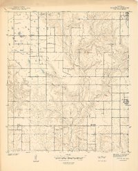
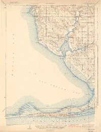
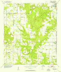
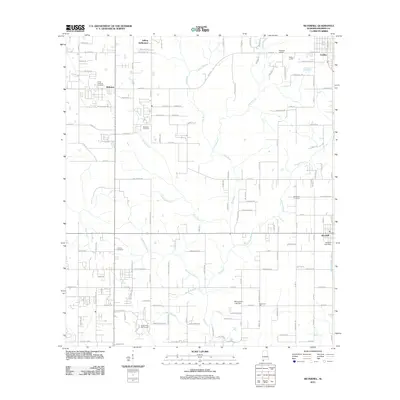
(42)- 1921 Map of Point Clear
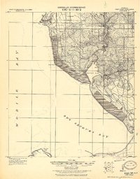 1921 Point Clear1921 Print · USGSThe eastern shore of Mobile Bay and its tidal inlets are captured here in the years following the Great War. Researchers can trace early coastal settlements like Point Clear, find family names at Seymours Bluff, and locate the historic Dixie Road corridor.2 unique versions available
 - 1921 Map of Fairhope
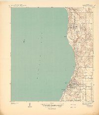
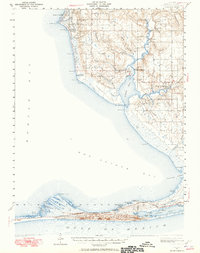
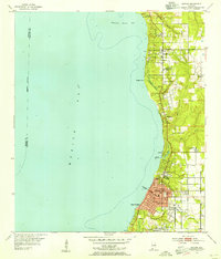
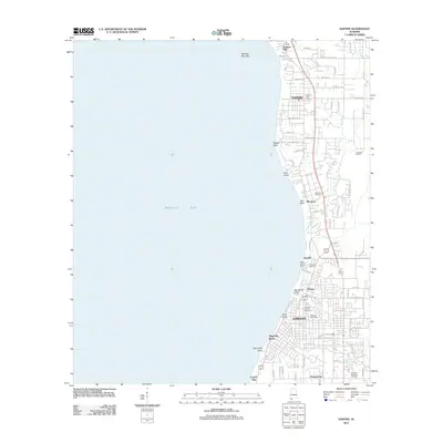
 1921 Fairhope1921 Print · USGSThe eastern shore of Mobile Bay comes alive in the early twentieth century as coastal colonies and timber towns expand. Trace the early streets of Fairhope and Daphne or follow the New Orleans Mobile and Pensacola R. R. through Loxley.
 - 1939 Map of Daphne
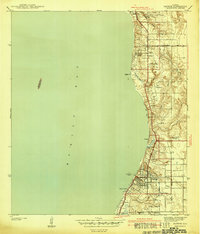
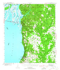
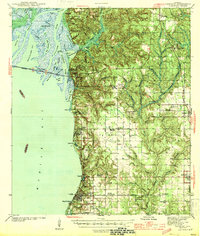
 1939 Daphne1939 Print · USGSThe eastern shore of Mobile Bay is captured here just before the mid-century, showing the early coastal development of Baldwin County. Genealogists and local historians can trace family roots through the Baldwin County Training School, Lebanon Chapel, and the historic Jackson Oak.
 - 1940 Map of Silverhill
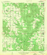
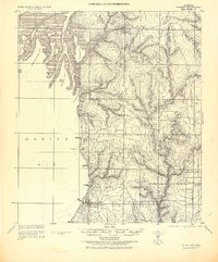
 1940 Silverhill1940 Print · USGSBaldwin County in the late 1930s reveals a patchwork of small farming communities and cultural enclaves organized around the Fish River. Researchers can trace early family sites like Yelling Settlement, locate the Friends Meetinghouse, and find the Bohemian Hall.
 - 1941 Map of Daphne
 1941 Daphne1941 Print · USGSThe Alabama shoreline along Mobile Bay appears here just before the Second World War, showing the early layouts of Fairhope and Daphne. Genealogists can trace family footprints at Jackson Oak, Lebanon Chapel, and the Loyola Catholic Home.2 unique versions available
 - 1941 Map of Silverhill
 1941 Silverhill1941 Print · USGSCoastal Alabama at the start of the 1940s reveals a community of small settlements and diverse cultural landmarks. Genealogists can trace family roots through sites like Yelling Settlement, Bohemian Hall, and the Silverhill Cem.
 - 1941 Map of Weeks Bay, 1965 Print
 1941 Weeks Bay1965 Print · USGSThe Alabama coast at the start of the 1940s reveals a world of bayous, river landings, and quiet maritime settlements. Trace family roots and local history through landmarks like Magnolia Springs, the Confederate Rest Cem, and Springhill Sch.2 unique versions available
 - 1941 Map of Fairhope, 1965 Print
 1941 Fairhope1965 Print · USGSEastern Baldwin County and the Mobile Bay shore come alive in the early 1940s, when coastal villages were connected by the Old Spanish Trail. Researchers can locate Civil War Trenches, family sites like Johns Log Cabin, and community centers like the Bohemian Hall.
 - 1942 Map of Silverhill
 1942 Silverhill1942 Print · USGSBaldwin County’s rural interior is captured here just before the mid-century, showing the established communities of Silverhill and Loxley. Researchers can trace old family sites near the Bohemian Hall, Yelling Settlement, and the Universal African Ch.
 - 1943 Map of Weeks Bay
 1943 Weeks Bay1943 Print · USGSBaldwin County's shoreline and river systems are captured here in the early 1940s, just as the coastal landscape was modernizing. Genealogists can trace family names and local sites at Confederate Rest Cem, Magnolia Springs, and McKenzie Ferry.3 unique versions available
 - 1943 Map of Fairhope
 1943 Fairhope1943 Print · USGSCoastal Baldwin County's eastern shore and interior come into focus in the early 1940s, showing the early infrastructure of the Mobile Bay region. Researchers can trace the development of bayside towns like Fairhope and Daphne alongside the L. & N. R. R. rail corridor through Silverhill.
 - 1944 Map of Fairhope
 1944 Fairhope1944 Print · USGSThe Eastern Shore of Mobile Bay is captured in the mid-1940s, showing the early development of coastal towns and the rural interior. Researchers can trace land use through sites like the Gulf Coast Experiment Station, Bohemian Hall, and Civil War Trenches.3 unique versions available
 - 1953 Map of Daphne, 1954 Print
 1953 Daphne1954 Print · USGSThe Eastern Shore of Mobile Bay is captured in the early fifties, showing the growth of coastal communities from Daphne to Fairhope. Genealogists and historians can locate family homes and community landmarks like the Baldwin Co Training Sch, Jackson Oak, and Tatumville.5 unique versions available
 - 1953 Map of Silverhill, 1955 Print
 1953 Silverhill1955 Print · USGSBaldwin County farmland and rural settlements are caught in detail during the early 1950s. Genealogists and historians can trace community roots at the Bohemian Hall, Yelling Settlement, and the Friends Meetinghouse along the banks of the Fish River.2 unique versions available
 - 1956 Map of Point Clear
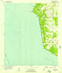 1956 Point Clear1956 Print · USGSMobile Bay's eastern shore in the mid-fifties is captured here as coastal communities like Point Clear and Battles Wharf began to grow. Genealogists and local historians can locate family sites at Twin Beach Cem, Bethel Ch, and the old settlement of Barnwell.2 unique versions available
 - 1957 Map of Pensacola, 1967 Print
 1957 Pensacola1967 Print · USGSThe Florida Panhandle and Alabama coast are seen here at the height of the Cold War, showcasing a unique mix of military aviation and emerging beach tourism. Genealogists and local historians can trace legacy sites like Old Corry Field, the lumber town of Bagdad, and the coastal reaches of Santa Rosa Island.3 unique versions available
 - 1959 Map of Pensacola
 1959 Pensacola1959 Print · USGSThe Florida Panhandle and Alabama coast come alive in this late fifties survey of military aviation and maritime life. Genealogists can trace family roots in Bagdad, Loxley, and Milton while mapping the rails of the Louisville and Nashville.
 - 1960 Map of Pensacola
 1960 Pensacola1960 Print · USGSThe Florida Panhandle and Alabama's eastern shore are shown during a period of rapid military and coastal growth. Genealogists and historians can trace the mid-century footprints of Warrington, the Pensacola NAS (Chevalier), and the Blackwater River timber lands.
 - 1966 Map of Point Clear, 1975 Print
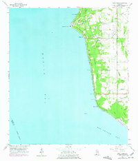 1966 Point Clear1975 Print · USGSBaldwin County's eastern shoreline is captured in the mid-1960s as coastal recreation and rural life began to coalesce. Genealogists and local historians can trace family sites at Confederate Rest Cem or locate historic water access points like Battles Wharf and Mullet Point.
 - 1978 Map of Pensacola, 1980 Print
 1978 Pensacola1980 Print · USGSThe Gulf Coast at the end of the 1970s reveals a landscape shaped by maritime industry and a heavy naval presence. Researchers can trace the development of Pensacola alongside quiet coastal hamlets like Magnolia Springs and the historic Fort Pickens State Park.3 unique versions available
 - 1980 Map of Magnolia Springs
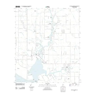
 1980 Magnolia Springs1980 Print · USGSCoastal Baldwin County is captured here in the late seventies, showing the tidal reach of Weeks Bay and the riverfront community of Magnolia Springs. Genealogists can locate family landmarks like Brook Cedron Cem, Clay City, and the Fish River Ch.3 unique versions available
 - 1981 Map of Bay Minette
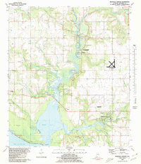
 1981 Bay Minette1981 Print · USGSThe Alabama-Florida borderlands come to life in the early 1980s as the river delta meets the growing coastal communities. Researchers can trace the Louisville and Nashville rail lines or locate historical points like Twenty-two Mile Bluff and the Blackwater River State Forest.2 unique versions available
 - 2011 Map of Silverhill, 2011 Print
 2011 Silverhill2011 Print · USGSCovers Fairhope, including Daphne, Loxley, and other nearby areas
 - 2011 Map of Daphne, 2011 Print
 2011 Daphne2011 Print · USGSCovers Fairhope, including Mobile, Daphne, and other nearby areas
 - 2011 Map of Magnolia Springs, 2011 Print
 2011 Magnolia Springs2011 Print · USGSCovers Fairhope, including Magnolia Springs, Yupon, and other nearby areas
Showing maps 1-25 of 42
Top cities near Fairhope
- Mobile historical maps
- Daphne historical maps
- Foley historical maps
- Prichard historical maps
- Gulf Shores historical maps
- Spanish Fort historical maps
See more
Top neighborhoods of Fairhope
- Volanta historical maps
- Seacliff historical maps
- Magnolia Beach historical maps
- Montrose historical maps
Frequently asked questions
- What are the different types of historical maps available for Fairhope?
- What is the oldest map of Fairhope?
- Where can I purchase historical maps of Fairhope for my home or office?
- Where can I download high-res historical maps of Fairhope?
- Are there historical topographic maps available for Fairhope?
- Is there historical aerial imagery available for Fairhope?
- Where are historical maps of Fairhope sourced from?