1970s Maps of Barbour County, Alabama
Explore 8 historic maps of Barbour County from the 1970s. These maps offer a rare glimpse into what life looked like during the 1970s — showing old roads, neighborhoods, homes, and landmarks that have changed or disappeared over time.
Whether you're researching your family's past, planning a metal detecting trip, or studying how Barbour County's landscape evolved across the 1970s, these high-resolution maps are a powerful tool for exploring the history of this region.
- Focus on a specific era: All maps on this page are from the 1970s, giving you a focused view of this time period.
- See what’s changed: Compare century-old streets, trails, and buildings to today's modern landscape using overlays and satellite layers.
- Research with precision: Use these maps for genealogy, historical research, land use analysis, or educational projects.
- View, download, or print: Maps are fully viewable online in high resolution, and can be downloaded or printed for your own records.
Start exploring Barbour County's history through authentic maps from the 1970s. This is your window into the past.
Barbour County, AL maps
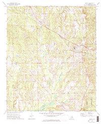
(8)- 1973 Map of Batesville, 1975 Print
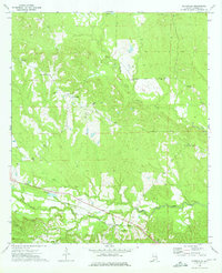 1973 Batesville1975 Print · USGSBarbour County in the early 1970s shows a landscape of small settlements and rural parishes along the Central of Georgia railroad. Genealogists can trace family landmarks like Friendship Cem, Spring Hill, and the Comer High Sch.
 - 1973 Map of Comer, 1975 Print
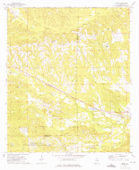 1973 Comer1975 Print · USGSBarbour and Bullock counties in the early seventies remained a landscape of rural tradition and railroad transit. Genealogists and local historians can trace family locations near Great Hope Ch, the Seay Cem, and the tracks of the Central of Georgia near Comer.
 - 1973 Map of Hurtsboro, 1975 Print
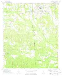 1973 Hurtsboro1975 Print · USGSThe rail crossroads at Hurtsboro remained a vital hub in the 1970s where two major lines intersected. Genealogists can locate several rural landmarks including St Pauls Cem, Enon, and Russell High Sch.
 - 1973 Map of Rutherford, 1975 Print
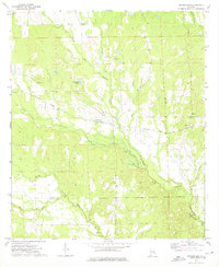 1973 Rutherford1975 Print · USGSSoutheast of Hurtsboro in the early 1970s, this area of the Alabama coastal plain remains a quiet landscape of rail lines and creek forks. Genealogists can trace rural community centers at Rutherford and Persons, or locate family landmarks like Mt Missouri Ch and Shady Grove Cem.
 - 1973 Map of Twin Springs, 1976 Print
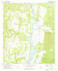 1973 Twin Springs1976 Print · USGSThe Alabama-Georgia borderlands are captured here in the early seventies as the reservoir waters reshaped the river valley. Genealogists can trace family roots through sites like Jernigan Ch Cem, Twin Springs, and the McClendon Cem.2 unique versions available
 - 1973 Map of Midway, 1976 Print
 1973 Midway1976 Print · USGSMidway and the rural stretches of Bullock and Barbour counties are captured here in the early 1970s. Researchers can trace family history through sites like Johnston Cem and Midway High Sch, or follow the path of the Indian Treaty Boundary.
 - 1973 Map of Howe, 1976 Print
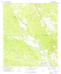 1973 Howe1976 Print · USGSThe Russell and Barbour county line in the early 1970s is a landscape of creek-bottom lowlands and rural crossroads. Researchers can trace family history through numerous landmarks like Glenville, Tennell Chapel Cem, and the Middle Fork Cowikee Creek.2 unique versions available
 - 1979 Map of Elamville, 1984 Print
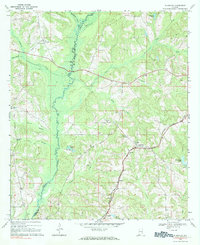 1979 Elamville1984 Print · USGSBarbour County and the Pike County line are shown in the late sixties as a network of small settlements and creek-side farms. Genealogists can trace family landmarks like Sutton Cem, Doster, and churches such as Sweet Oak Ch.
End of results
Showing maps 1-8 of 8
Top cities of Barbour County
- Eufaula historical maps
- Clayton historical maps
- Clio historical maps
- Louisville historical maps
- Bakerhill historical maps
- Blue Springs historical maps
Frequently asked questions
- What are the different types of historical maps available for Barbour County?
- What is the oldest map of Barbour County?
- Where can I purchase historical maps of Barbour County for my home or office?
- Where can I download high-res historical maps of Barbour County?
- Are there historical topographic maps available for Barbour County?
- Is there historical aerial imagery available for Barbour County?
- Where are historical maps of Barbour County sourced from?