Old Maps of Barbour County, Alabama for Metal Detecting
Plan your next treasure hunt with 172 historic maps of Barbour County. Find old homesites, ghost towns, trails, and gathering spots that may be lost to time — perfect for identifying promising metal detecting locations.
- Locate forgotten sites: Uncover places like long-lost settlements, abandoned rail lines, or gathering spots.
- Plan better hunts: Use map overlays combined with LiDAR or satellite views to narrow in on historically rich areas.
- Made for detectorists: Thousands of hobbyists use these maps to discover relics, coins, and hidden history.
Use these historic maps to boost your research and find new opportunities beneath the surface of Barbour County.
Barbour County, AL maps
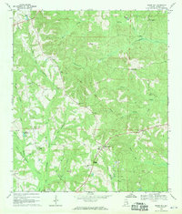
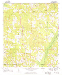
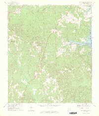
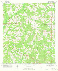
(172)- 1953 Map of Dothan, 1966 Print
 1953 Dothan1966 Print · USGSSoutheast Alabama and Southwest Georgia are captured during a period of massive hydraulic and military expansion in the mid-fifties. Genealogists and historians can trace rural landmarks like Antioch Church and School, the Andrew Jackson Monument, and the early footprint of Fort Rucker Military Reservation.3 unique versions available
 - 1954 Map of Dothan
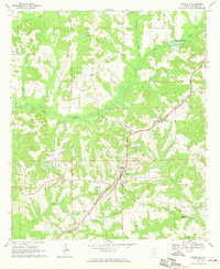
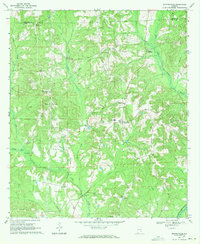
 1954 Dothan1954 Print · USGSSoutheast Alabama and Southwest Georgia are seen here in the mid-fifties, during a decade of military expansion and rural transition. Genealogists can trace the location of country schools like Little Zion School or the grounds of Kolomoki Mounds State Park.
 - 1955 Map of Dothan
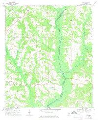
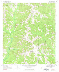
 1955 Dothan1955 Print · USGSSoutheast Alabama and Southwest Georgia are captured here in the mid-fifties, showing a landscape of river-port history and growing military bases. Researchers can trace rural life via the Andrew Jackson Monument, Bauxite mines, and the Central of Georgia RR.
 - 1955 Map of Phenix City, 1964 Print
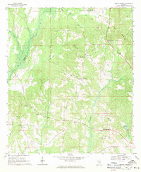
 1955 Phenix City1964 Print · USGSPost-war Alabama and Georgia meet along the Chattahoochee River as industry and military installations expand. Trace the rail lines of the Central of Georgia through towns like Opelika, Tuskegee, and Alexander City.3 unique versions available
 - 1957 Map of Phenix City
 1957 Phenix City1957 Print · USGSThe Alabama-Georgia borderlands are captured here in the mid-fifties, centered on the bustling river crossing at Phenix City and Columbus. Researchers can trace the mid-century footprint of the Fort Benning Military Reservation or locate smaller textile and railroad towns like Langdale and Camp Hill.
 - 1957 Map of Pittsview, 1958 Print
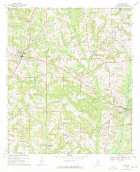
 1957 Pittsview1958 Print · USGSSoutheast Alabama in the late fifties remains a landscape defined by rail and creek-side settlements. Genealogists can trace family footprints around Pittsview, Hooks, and rural landmarks like Macedonia Ch or the Mitchell Sch.3 unique versions available
 - 1958 Map of Phenix City
 1958 Phenix City1958 Print · USGSThe Alabama-Georgia borderlands thrive during the late fifties, anchored by the river-driven industry of Columbus and Phenix City. Researchers can trace the mid-century footprints of Fort Benning, Auburn, and the textile towns of Fairfax and Lanett.
 - 1967 Map of Clayton South, 1970 Print
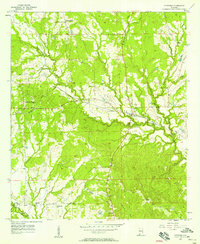
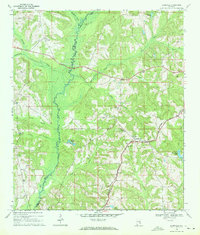
 1967 Clayton South1970 Print · USGSBarbour County in the late sixties reveals a landscape shaped by long-standing treaty boundaries and a network of rural congregations. Genealogists can trace family connections through numerous landmarks like Tabernacle Cem, Antioch Ch, and the Old Indian Treaty Bdy.
 - 1967 Map of Georgetown, 1970 Print
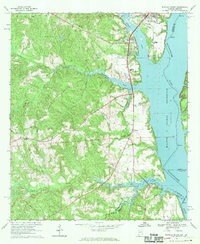
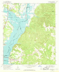 1967 Georgetown1970 Print · USGSThe Quitman County shoreline underwent a dramatic shift in the late sixties as the Chattahoochee River valley was reshaped by new reservoirs. Researchers can trace the submerged geography near Georgetown and locate rural landmarks like Keglar Sch or Bumbleton Courthouse Cem.2 unique versions available
 - 1968 Map of Eufaula North, 1970 Print
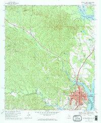 1968 Eufaula North1970 Print · USGSThe Alabama-Georgia borderlands near Eufaula are captured here in the late sixties, just as the reservoir reshaped the riverfront. Researchers can trace family roots at St James Ch, Shorter Cem, and the historic rail corridor of the Central of Georgia.2 unique versions available
 - 1968 Map of Baker Hill, 1970 Print
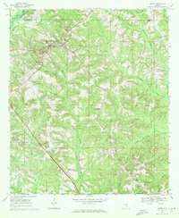
 1968 Baker Hill1970 Print · USGSSoutheast Alabama in the late sixties reveals a landscape shaped by historical lines and rural tradition. Genealogists and historians can trace the Old Indian Treaty Boundary while locating community landmarks like Rocky Mount Ch, Peggy Bottom, and St Pauls Ch.
 - 1968 Map of White Oak, 1970 Print
 1968 White Oak1970 Print · USGSBarbour County's rural heartland is captured here in the late 1960s. Genealogists can trace family roots through sites like the Perkins-Evans Cem, Wyecott Plantation, and Palmyra Ch along the Central of Georgia rail line.
 - 1968 Map of Clayton North, 1970 Print
 1968 Clayton North1970 Print · USGSBarbour County in the late sixties shows a landscape where historic boundary lines and rail corridors still shaped daily life. Trace family roots at Flourney Cem, locate the old County Training Sch, or follow the Old Indian Treaty Boundary Road.2 unique versions available
 - 1968 Map of Eufaula South, 1970 Print
 1968 Eufaula South1970 Print · USGSNear the Alabama-Georgia border in the late sixties, the landscape around the reservoir reveals a mix of river industry and deep-rooted rural life. Genealogists and local historians can trace the Old Indian Treaty Bdy and locate landmarks like Bluff City Sch and Epworth Ch.2 unique versions available
 - 1968 Map of Perote, 1970 Print
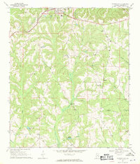
 1968 Perote1970 Print · USGSSoutheastern Bullock County and its neighbors come alive in this late 1960s survey of Alabama's Black Belt region. Genealogists and local historians can trace family roots through rural landmarks like Blues Old Stand, Smuteye, and the Mt Hilliard Ch cemetery.
 - 1968 Map of Louisville, 1971 Print
 1968 Louisville1971 Print · USGSBarbour County's rural landscape is captured here in the late sixties, centered on the railroad town of Louisville. Genealogists and historians can trace family locations through numerous rural churches like Salem Ch and landmarks like Robertson Millpond or Dixie Academy.
 - 1968 Map of Josie, 1971 Print
 1968 Josie1971 Print · USGSSoutheast Alabama’s rural borderlands are documented here in the late sixties, showing the small farming communities established along the Pea River valley. Genealogists and researchers can trace local families through many rural landmarks, including Hobdys Bridge, Ephesus Cem, and Loflin Ch.2 unique versions available
 - 1968 Map of Mount Andrew, 1971 Print
 1968 Mount Andrew1971 Print · USGSBarbour County was a landscape of remote crossroads and creek-side mills in the late sixties. Genealogists can trace family footprints through numerous rural landmarks like Street Memorial Ch, Williams Millpond, and the Old Indian Treaty Boundary.
 - 1969 Map of Fort Gaines NW, 1970 Print
 1969 Fort Gaines NW1970 Print · USGSHenry and Barbour Counties are captured here in the late sixties as the rising Walter F George Res meets the rural uplands. Researchers can trace the Indian Treaty Boundary past rural crossroads like Screamer and find old family landmarks such as Old Judson Cem.2 unique versions available
 - 1969 Map of Elamville, 1971 Print
 1969 Elamville1971 Print · USGSBarbour and Pike counties are captured in the late sixties as the Pea River wetlands and family farms shaped local life. Genealogists can trace rural roots through landmarks like St Pauls Cem Ch, the Central of Georgia rail line, and Sutton Cem.
 - 1969 Map of Clio, 1971 Print
 1969 Clio1971 Print · USGSBarbour County in the late sixties shows a landscape of established family farms and small crossroads settlements tied together by the Central of Georgia railroad. Genealogists and local historians can trace rural landmarks from Blue Springs State Park to small churches like Fine Hope Ch and Antioch Ch.2 unique versions available
 - 1969 Map of Ariton, 1971 Print
 1969 Ariton1971 Print · USGSSoutheast Alabama's Wiregrass region comes alive in the late sixties as a busy rail junction where two major lines meet. Genealogists can trace family names at the Universalist Cem, Sammon Cem, or the Pleasant Grove Ch (Cem).2 unique versions available
 - 1969 Map of Texasville, 1971 Print
 1969 Texasville1971 Print · USGSSoutheast Alabama in the late sixties reveals a landscape of quiet rural hamlets and family-named ridges along the Barbour and Henry county line. Genealogists and historians can trace local community roots through landmarks like Blue Springs Sch, St Peters Ch, and the settlement of Texasville.
 - 1969 Map of Skipperville, 1971 Print
 1969 Skipperville1971 Print · USGSThe rural crossroads and river valleys of Dale County are documented in this late-sixties survey. Researchers can trace family sites at Phillips Crossroads, locate the Skipperville Sch, or find old stream crossings like Bottoms Mill Bridge.
 - 1969 Map of Clopton, 1971 Print
 1969 Clopton1971 Print · USGSSoutheast Alabama in the late sixties reveals a network of crossroads communities and small rural churches. Genealogists can trace family roots at Mt Carmel Ch, Wesley Chapel, and the settlements of Clopton and Bertha along the Choctawhatchee River.2 unique versions available
Showing maps 1-25 of 172
Top cities of Barbour County
- Eufaula historical maps
- Clayton historical maps
- Clio historical maps
- Louisville historical maps
- Bakerhill historical maps
- Blue Springs historical maps
Frequently asked questions
- What are the different types of historical maps available for Barbour County?
- What is the oldest map of Barbour County?
- Where can I purchase historical maps of Barbour County for my home or office?
- Where can I download high-res historical maps of Barbour County?
- Are there historical topographic maps available for Barbour County?
- Is there historical aerial imagery available for Barbour County?
- Where are historical maps of Barbour County sourced from?