Old Maps of Snead, Alabama for Metal Detecting
Plan your next treasure hunt with 35 historic maps of Snead. Find old homesites, ghost towns, trails, and gathering spots that may be lost to time — perfect for identifying promising metal detecting locations.
- Locate forgotten sites: Uncover places like long-lost settlements, abandoned rail lines, or gathering spots.
- Plan better hunts: Use map overlays combined with LiDAR or satellite views to narrow in on historically rich areas.
- Made for detectorists: Thousands of hobbyists use these maps to discover relics, coins, and hidden history.
Use these historic maps to boost your research and find new opportunities beneath the surface of Snead.
Snead, AL maps
(35)- 1885 Map of Gadsden
 1885 Gadsden1885 Print · USGSNortheast Alabama in the mid-1880s was a landscape of river-side landings and emerging rail towns. Genealogists and historians can trace the early foundations of Guntersville and Gadsden while locating rural landmarks like Hillian Store, Cottonville, and Law Landing.
 - 1888 Map of Gadsden
 1888 Gadsden1888 Print · USGSNorth Alabama's river valleys and plateau lands are captured here in the late nineteenth century as the region transitioned from river landings to rail transport. Researchers can locate early post offices and commerce centers like Hillian's Store, Guntersville, and the ferry at Ft Deposit.
 - 1892 Map of Gadsden
 1892 Gadsden1892 Print · USGSNorth Alabama's river-and-rail economy is captured here in the late nineteenth century as Guntersville and Gadsden emerge as regional hubs. Genealogists and historians can trace the routes of the Birmingham Mineral R. R. or locate old community centers like Cottonville and Mt Zion.
 - 1895 Map of Gadsden
 1895 Gadsden1895 Print · USGSNortheast Alabama at the close of the century was a landscape of river landings and mountain gaps where the Tennessee River met growing rail hubs. Genealogists can trace family holdings near Hillian Store, Cottonville, and the remote heights of Lookout Mountain.
 - 1903 Map of Gadsden
 1903 Gadsden1903 Print · USGSNorthern Alabama in the late nineteenth century centers on the busy Tennessee River corridor and its surrounding ridges. Trace old family sites and transport hubs like Hillian Store, Lovelace Landing, and the Mt Zion church.4 unique versions available
 - 1936 Map of Brooksville
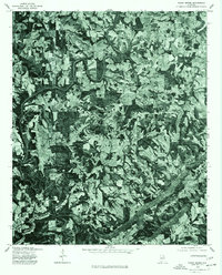
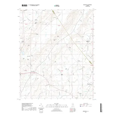
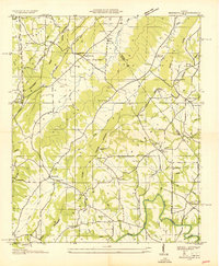 1936 Brooksville1936 Print · USGSBlount and Marshall Counties meet in the mid-1930s among the ridgelines of the Cherokee Basin. Researchers can trace the early road network of Old Tennessee State Highway No 38 to find old community hubs like Nixon Chapel and Oak Hill Sch.
 - 1956 Map of Gadsden, 1966 Print
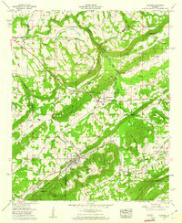
 1956 Gadsden1966 Print · USGSNorth Alabama in the mid-1950s shows a region transformed by river engineering and federal industry. Genealogists and local historians can trace the development of the Tennessee Valley through the growth of Huntsville, the sprawling Redstone Arsenal, and the expansive Guntersville Lake.3 unique versions available
 - 1958 Map of Gadsden
 1958 Gadsden1958 Print · USGSNorth Alabama comes alive in the late 1950s as the Tennessee Valley Authority’s massive river projects and the rise of the space industry reshaped the landscape. Researchers can trace the mid-century footprints of Huntsville, Redstone Arsenal, and the riverside rail networks of the Southern railroad.
 - 1958 Map of Altoona, 1960 Print
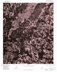
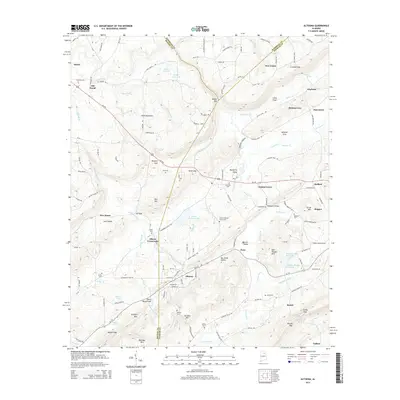
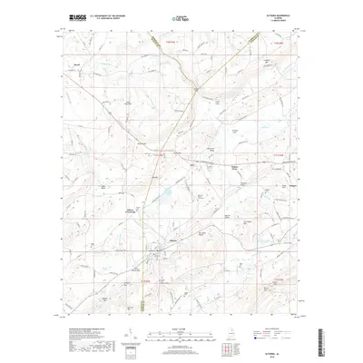
 1958 Altoona1960 Print · USGSThe northern Alabama mountain-and-valley landscape comes into focus here in the late fifties, showcasing the mining and rail activity surrounding Altoona. Genealogists and local historians can locate many family-named landmarks, including the Robbins Cemetery, Snead Chapel, and the Thompson Bridge.3 unique versions available
 - 1958 Map of Susan Moore, 1960 Print
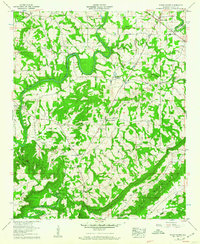 1958 Susan Moore1960 Print · USGSBlount County in the late fifties shows a rural Alabama landscape defined by the winding Locust Fork. Researchers can trace old family sites near Snead Crossroads, locate the Royal Sch, or find ancestral plots at Mt Moriah Cem and Brown Cem.3 unique versions available
 - 1958 Map of Brooksville, 1960 Print
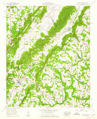 1958 Brooksville1960 Print · USGSNorth-central Alabama in the late fifties shows a rural landscape defined by deep valleys and the OLD CHEROKEE BOUNDARY. Genealogists and local historians can trace family locations through Eagle Sch, Dickson Cem, and settlements like Brooksville and Summit.3 unique versions available
 - 1960 Map of Gadsden
 1960 Gadsden1960 Print · USGSNorthern Alabama in the mid-1950s is defined by the mighty Tennessee River and its massive reservoirs. Trace the development of Huntsville and Redstone Arsenal or explore the vast William B Bankhead National Forest.2 unique versions available
 - 1963 Map of Gadsden
 1963 Gadsden1963 Print · USGSNorthern Alabama underwent a dramatic mid-century transformation as the Tennessee Valley became a hub for defense and industry. Researchers can trace the development of the Redstone Arsenal, the route of the Natchez Trace Parkway, and long-standing rail lines like the Southern Railway.
 - 1975 Map of Susan Moore, 1977 Print
 1975 Susan Moore1977 Print · USGSBlount County land patterns are captured in detail in the mid-1970s, showing the transition between family farms and woodland. Researchers can pinpoint specific homesteads and road networks around Susan Moore, Snead Crossroads, and Hendrix.2 unique versions available
 - 1975 Map of Brooksville, 1977 Print
 1975 Brooksville1977 Print · USGSBlount County comes into sharp focus during the mid-seventies in this detailed orthophotograph of the northern Alabama countryside. Local historians and land researchers can trace the specific field boundaries and rural road networks connecting Brooksville and Nixon Chapel.2 unique versions available
 - 1975 Map of Altoona, 1977 Print
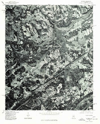 1975 Altoona1977 Print · USGSNorth Alabama's rural landscape comes into focus in the mid-1970s through this aerial orthophotomap of Etowah County. Researchers can trace the development of small communities like Altoona, Walnut Grove, and Snead against the backdrop of local timber and farm land.2 unique versions available
 - 1984 Map of Guntersville, 1985 Print
 1984 Guntersville1985 Print · USGSNorthern Alabama at the start of the eighties shows a landscape shaped by massive TVA impoundments and a robust rail network. Genealogists and historians can trace family land across Brindley Mountain or near old rail stops on the Louisville and Nashville RR and Southern Ry.2 unique versions available
 - 2011 Map of Brooksville, 2011 Print
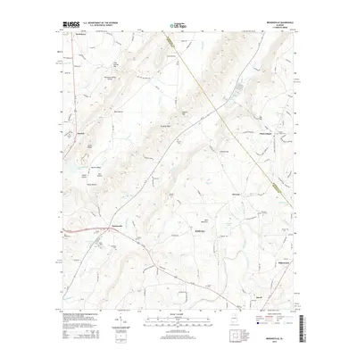
 2011 Brooksville2011 Print · USGSCovers Snead, including Nixon Chapel, Bright Star, and other nearby areas
 - 2011 Map of Clarence, 2011 Print
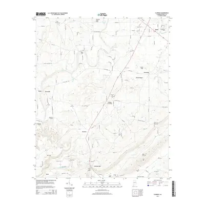
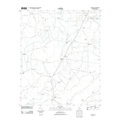 2011 Clarence2011 Print · USGSCovers Snead, including Susan Moore, Rosa, and other nearby areas
 - 2011 Map of Altoona, 2011 Print
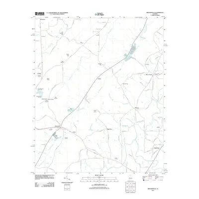
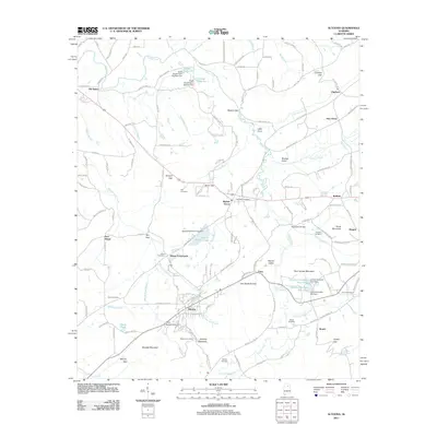 2011 Altoona2011 Print · USGSCovers Snead, including New Union, Altoona, and other nearby areas
 - 2014 Map of Brooksville, 2014 Print
 2014 Brooksville2014 Print · USGSCovers Snead, including Nixon Chapel, Bright Star, and other nearby areas
 - 2014 Map of Clarence, 2014 Print
 2014 Clarence2014 Print · USGSCovers Snead, including Susan Moore, Rosa, and other nearby areas
 - 2014 Map of Altoona, 2014 Print
 2014 Altoona2014 Print · USGSCovers Snead, including New Union, Altoona, and other nearby areas
 - 2018 Map of Brooksville, 2018 Print
 2018 Brooksville2018 Print · USGSCovers Snead, including Nixon Chapel, Bright Star, and other nearby areas
 - 2018 Map of Altoona, 2018 Print
 2018 Altoona2018 Print · USGSCovers Snead, including New Union, Altoona, and other nearby areas
Showing maps 1-25 of 35
Top cities near Snead
- Albertville historical maps
- Rainbow City historical maps
- Boaz historical maps
- Guntersville historical maps
- Arab historical maps
- Oneonta historical maps
See more
Top neighborhoods of Snead
Frequently asked questions
- What are the different types of historical maps available for Snead?
- What is the oldest map of Snead?
- Where can I purchase historical maps of Snead for my home or office?
- Where can I download high-res historical maps of Snead?
- Are there historical topographic maps available for Snead?
- Is there historical aerial imagery available for Snead?
- Where are historical maps of Snead sourced from?