1900s (20th Century) Maps of Georgiana, Alabama
Explore 7 historic maps of Georgiana from the 1900s (20th Century). These maps offer a rare glimpse into what life looked like during the 1900s — showing old roads, neighborhoods, homes, and landmarks that have changed or disappeared over time.
Whether you're researching your family's past, planning a metal detecting trip, or studying how Georgiana's landscape evolved across the 1900s, these high-resolution maps are a powerful tool for exploring the history of this region.
- Focus on a specific era: All maps on this page are from the 1900s, giving you a focused view of this time period.
- See what’s changed: Compare century-old streets, trails, and buildings to today's modern landscape using overlays and satellite layers.
- Research with precision: Use these maps for genealogy, historical research, land use analysis, or educational projects.
- View, download, or print: Maps are fully viewable online in high resolution, and can be downloaded or printed for your own records.
Start exploring Georgiana's history through authentic maps from the 1900s. This is your window into the past.
Georgiana, AL maps
(7)- 1953 Map of Andalusia, 1965 Print
 1953 Andalusia1965 Print · USGSSouth Alabama in the mid-twentieth century remains a land of pine forests and river-fed settlements. You can trace the vital rail corridors of the Louisville & Nashville and locate regional centers such as Andalusia, Brewton, and Monroeville.3 unique versions available
 - 1957 Map of Andalusia
 1957 Andalusia1957 Print · USGSSouthern Alabama in the mid-1950s was a landscape defined by timbered stretches and the rhythmic flow of the Alabama River. Researchers can trace the legacy of the rail era through the Central of Georgia tracks and the storied river bluffs at Choctaw Bluff.
 - 1971 Map of Mc Kenzie, 1973 Print
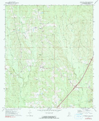
 1971 Mc Kenzie1973 Print · USGSButler County and the surrounding tri-county borderlands appear here in the early seventies, centered on the railroad town of Mc Kenzie. Genealogists can trace family locations through sites like South Butler Academy, Riley Cem, and Sweet Home Ch.2 unique versions available
 - 1971 Map of Georgiana East, 1973 Print
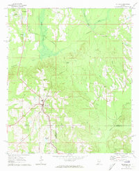
 1971 Georgiana East1973 Print · USGSButler County's rural landscape is captured here in the early seventies, showing a network of creek-side settlements and country roads. Genealogists and historians can locate family landmarks such as Stamps Cem, Providence, and Mt Pisgah Ch.3 unique versions available
 - 1971 Map of Garland, 1974 Print
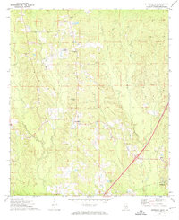
 1971 Garland1974 Print · USGSButler and Conecuh Counties appear here in the early 1970s, as rural life centered on the Sepulga River and the Louisville and Nashville railroad. Genealogists can trace family names at Sellers Cem, McClure Cem, and small congregations like St John Ch.2 unique versions available
 - 1971 Map of Georgiana West, 1991 Print
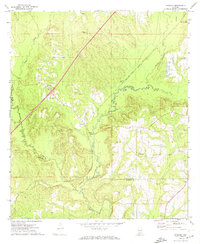
 1971 Georgiana West1991 Print · USGSButler County as it appeared in the early seventies shows the established rural life and road networks surrounding Georgiana. Genealogists and historians can trace family roots through landmarks like Stamps Cem, Morrow Ch, and the community at Starlington.
 - 1986 Map of Greenville
 1986 Greenville1986 Print · USGSMid-century South Central Alabama comes alive in this survey of the creek-laced timberlands and rail-dependent towns between the Gulf Coastal Plain and the Piedmont. Researchers can trace family roots through numerous country landmarks like Magnolia Cem, Spring Hill Ch, and the Butler County State Wildlife Management Area.2 unique versions available
End of results
Showing maps 1-7 of 7
Top cities near Georgiana
- Greenville historical maps
- Evergreen historical maps
- McKenzie historical maps
- Red Level historical maps
- Pine Apple historical maps
Frequently asked questions
- What are the different types of historical maps available for Georgiana?
- What is the oldest map of Georgiana?
- Where can I purchase historical maps of Georgiana for my home or office?
- Where can I download high-res historical maps of Georgiana?
- Are there historical topographic maps available for Georgiana?
- Is there historical aerial imagery available for Georgiana?
- Where are historical maps of Georgiana sourced from?