1960s Maps of Lanett, Alabama
Explore 2 historic maps of Lanett from the 1960s. These maps offer a rare glimpse into what life looked like during the 1960s — showing old roads, neighborhoods, homes, and landmarks that have changed or disappeared over time.
Whether you're researching your family's past, planning a metal detecting trip, or studying how Lanett's landscape evolved across the 1960s, these high-resolution maps are a powerful tool for exploring the history of this region.
- Focus on a specific era: All maps on this page are from the 1960s, giving you a focused view of this time period.
- See what’s changed: Compare century-old streets, trails, and buildings to today's modern landscape using overlays and satellite layers.
- Research with precision: Use these maps for genealogy, historical research, land use analysis, or educational projects.
- View, download, or print: Maps are fully viewable online in high resolution, and can be downloaded or printed for your own records.
Start exploring Lanett's history through authentic maps from the 1960s. This is your window into the past.
Lanett, AL maps
(2)- 1964 Map of Lanett North, 1965 Print
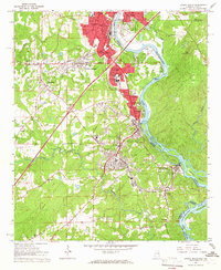
 1964 Lanett North1965 Print · USGSThe industrial and civic heart of the Alabama-Georgia border comes into focus in this mid-sixties survey. Local historians can trace the development of Lanett and West Point through sites like Fort Tyler Cem, Harrison High Sch, and the Atlanta and West Point Railroad.4 unique versions available
 - 1964 Map of Lanett South, 1966 Print
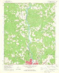
 1964 Lanett South1966 Print · USGSThe industrial corridor of the Chattahoochee Valley comes alive here in the mid-1960s, showing the tight-knit mill towns and rail networks of eastern Alabama. Researchers can trace the legacy of local families through Oak Wood Cem, Huguley Cem, and numerous country churches like Greenwood Ch.4 unique versions available
End of results
Showing maps 1-2 of 2
Top cities near Lanett
- Columbus historical maps
- Auburn historical maps
- Opelika historical maps
- LaGrange historical maps
- Valley historical maps
- West Point historical maps
See more
Top neighborhoods of Lanett
Frequently asked questions
- What are the different types of historical maps available for Lanett?
- What is the oldest map of Lanett?
- Where can I purchase historical maps of Lanett for my home or office?
- Where can I download high-res historical maps of Lanett?
- Are there historical topographic maps available for Lanett?
- Is there historical aerial imagery available for Lanett?
- Where are historical maps of Lanett sourced from?