1900s (20th Century) Maps of Clay County, Alabama
Explore 38 historic maps of Clay County from the 1900s (20th Century). These maps offer a rare glimpse into what life looked like during the 1900s — showing old roads, neighborhoods, homes, and landmarks that have changed or disappeared over time.
Whether you're researching your family's past, planning a metal detecting trip, or studying how Clay County's landscape evolved across the 1900s, these high-resolution maps are a powerful tool for exploring the history of this region.
- Focus on a specific era: All maps on this page are from the 1900s, giving you a focused view of this time period.
- See what’s changed: Compare century-old streets, trails, and buildings to today's modern landscape using overlays and satellite layers.
- Research with precision: Use these maps for genealogy, historical research, land use analysis, or educational projects.
- View, download, or print: Maps are fully viewable online in high resolution, and can be downloaded or printed for your own records.
Start exploring Clay County's history through authentic maps from the 1900s. This is your window into the past.
Clay County, AL maps
(38)- 1943 Map of Talladega, 1972 Print
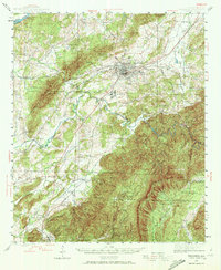 1943 Talladega1972 Print · USGSTalladega and its mountain ridges are captured here during the early years of the Second World War, showing a landscape defined by rail and rural industry. Researchers can trace family roots through numerous country landmarks like Reynolds Mill, the County Training School, and Winterboro.2 unique versions available
 - 1944 Map of Goodwater, 1947 Print
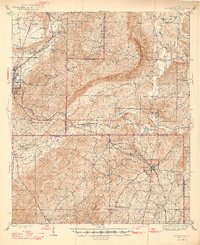 1944 Goodwater1947 Print · USGSThe hill country of Coosa and Talladega counties is captured here just after the war, showing the railroad-industrial corridor from Sylacauga to Goodwater. Genealogists and historians can trace numerous rural sites like Trammells Sch, Haynes Chapel, and the remote Hollins Fire Tower.3 unique versions available
 - 1946 Map of Talladega
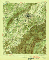 1946 Talladega1946 Print · USGSTalladega and its surrounding hill country are captured here in the mid-1940s as a vital railroad and milling crossroads. Genealogists can locate family landmarks like Allison Mills, Antioch Ch, and the Mardisville Sch among the rural settlements.2 unique versions available
 - 1947 Map of Goodwater
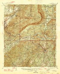 1947 Goodwater1947 Print · USGSCoosa and Talladega counties in the mid-1940s are shown as a network of rail-side towns and ridge-top lookouts. Genealogists and historians can locate rural landmarks like Hatchet Springs Sch, the Hollins Fire Tower, and the historic Wiregrass Road.2 unique versions available
 - 1953 Map of Birmingham, 1964 Print
 1953 Birmingham1964 Print · USGSCentral Alabama at mid-century shows a landscape defined by industrial expansion and the iron-rich ridges surrounding Birmingham. Researchers can trace the extensive rail networks of the L & N RR or locate historic federal sites like the Anniston Ordnance Depot.4 unique versions available
 - 1953 Map of Atlanta, 1965 Print
 1953 Atlanta1965 Print · USGSThe growing Atlanta metro and the industrial corridors of Eastern Alabama are captured here during the mid-century transition. Researchers can trace the rail-to-road shift through hubs like Anniston and La Grange or locate sites within Fort McClellan.2 unique versions available
 - 1956 Map of Birmingham
 1956 Birmingham1956 Print · USGSCentral Alabama in the mid-fifties exhibits a landscape of growing cities and deep-rooted industrial corridors. Genealogists and historians can trace the development of suburban Mountain Brook or locate regional hubs like Sylacauga and Jasper.
 - 1957 Map of Birmingham
 1957 Birmingham1957 Print · USGSNorth-Central Alabama in the mid-fifties is an industrial powerhouse centered on the steel valleys and sprawling iron ridges. Genealogists and historians can trace the rail-linked growth of Birmingham and Tuscaloosa, or locate rural landmarks like Talladega College and the Anniston Ordnance Depot.
 - 1957 Map of Atlanta
 1957 Atlanta1957 Print · USGSAtlanta and the Alabama borderlands appear here in the mid-fifties, capturing the region's post-war suburban and industrial transition. Trace the development of early transport hubs and military sites like Fort McPherson, Anniston, and the Kennesaw Mountain National Battlefield Park.
 - 1958 Map of Atlanta
 1958 Atlanta1958 Print · USGSMid-century Georgia and Alabama are shown in this regional study of the corridor between the Chattahoochee River and the Appalachian foothills. Local historians can trace the development of suburban Atlanta alongside vital landmarks like Stone Mountain, Dobbins AFB, and the Seaboard Air Line rail routes.
 - 1969 Map of New Site, 1973 Print
 1969 New Site1973 Print · USGSTallapoosa County's rural heartland is meticulously documented in this late 1960s survey as small communities like Goldville and New Site began to modernize. Genealogists and historians can trace long-standing landmarks such as Old Salem Cem, Bethlehem Ch, and the isolated Fosheeton settlement.
 - 1969 Map of Clairmont Springs, 1973 Print
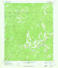
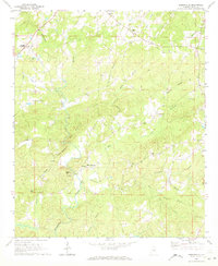
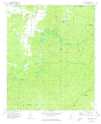
 1969 Clairmont Springs1973 Print · USGSClay and Talladega Counties appear here in the late sixties as the mountain railroad and national forest defined local life. Genealogists and historians can trace family landmarks like Poe Bridge Cem, rural churches such as Liberty Ch, and the old Gold Mines at the edge of the forest.4 unique versions available
 - 1969 Map of Millerville, 1973 Print
 1969 Millerville1973 Print · USGSThe rural community of Millerville and the southern reaches of the Talladega National Forest are documented here as they stood in the late 1960s. Researchers can locate generational landmarks like Graves High Sch, Carr Mill, and numerous country churches including Oaks Chapel.3 unique versions available
 - 1969 Map of Hackneyville, 1973 Print
 1969 Hackneyville1973 Print · USGSTallapoosa and Clay counties come into focus in the late sixties, revealing a rural network of crossroads and creek-side settlements. Family historians can trace ancestral sites like Old Providence Cem, New Hope Ch, and the community hub at Hackneyville.2 unique versions available
 - 1969 Map of Gibsonville, 1973 Print
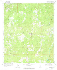
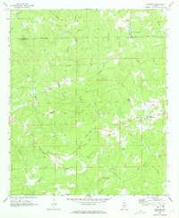
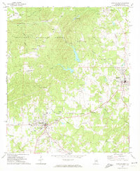
 1969 Gibsonville1973 Print · USGSClay County at the end of the 1960s was a landscape of high ridges and winding creek bottoms defined by isolated mountain communities. Genealogists and local historians can trace the foundations of this area through landmarks like Harkins Crossroads, Bluff Springs, and Liberty Hill Church.
 - 1969 Map of Daviston, 1973 Print
 1969 Daviston1973 Print · USGSThe rural borderlands of Tallapoosa and Clay counties come into focus during the late 1960s. Researchers can trace local heritage through sites like the Zana Training School, the Old Vickers Cemetery, and the Rocky Mount Lookout Tower.
 - 1969 Map of Mellow Valley, 1973 Print
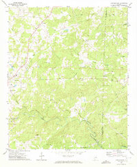
 1969 Mellow Valley1973 Print · USGSClay and Randolph Counties in the late sixties remain a landscape of rural junctions and small-town outposts. Genealogists and local historians can trace family locations near Cooley Crossroads, McDaniel Cem, and the old High Sch at Mellow Valley.2 unique versions available
 - 1969 Map of Cheaha Mountain, 1974 Print
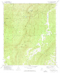 1969 Cheaha Mountain1974 Print · USGSThe Alabama highlands are captured here in the late sixties, centered on the state's highest peaks and the protected forests of the Talladega range. Genealogists and hikers can trace the original Odum Trail and locate rural landmarks like Mannings Chapel and Union.2 unique versions available
 - 1969 Map of Lineville West, 1974 Print
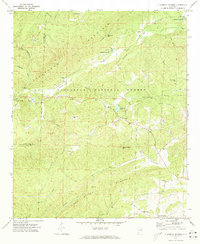
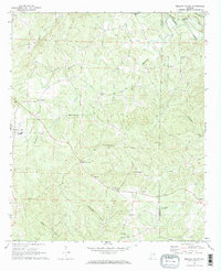
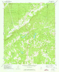
 1969 Lineville West1974 Print · USGSCentral Clay County comes alive in the late sixties as the local economy transitions between the rail-side hamlets of Pyriton and the growing hubs of Ashland and Lineville. Trace rural heritage through landmarks like Shireys Mill, Old Field Cem, and the County Training Sch.2 unique versions available
 - 1969 Map of Ironaton, 1974 Print
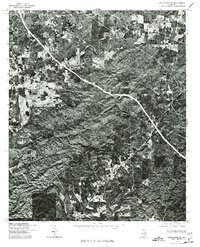
 1969 Ironaton1974 Print · USGSTalladega County is shown in the late sixties as a landscape of mountain ridges and quiet settlements within the Talladega National Forest. Researchers can trace the Louisville and Nashville line past Ironaton or find family landmarks like Providence Ch and Guntertown.
 - 1970 Map of Delta, 1973 Print
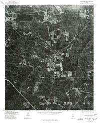
 1970 Delta1973 Print · USGSThe upland forests and creek valleys of rural Clay County are captured here in the early 1970s. Genealogists can trace family landmarks like Ragan Chapel Cem and Pleasant Hill Cem near the settlements of Delta and Needmore.2 unique versions available
 - 1970 Map of Lineville East, 1973 Print
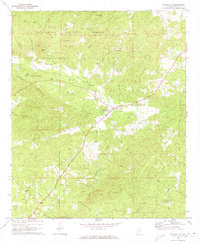
 1970 Lineville East1973 Print · USGSClay County's rural heartland is documented here in the early 1970s as agricultural life centered around the railroad and local creeks. Researchers can trace the path of the Seaboard Coast Line or locate family sites like Sweetwater Cem and Barfield.2 unique versions available
 - 1975 Map of Goodwater SE, 1977 Print
 1975 Goodwater SE1977 Print · USGSCoosa County territory during the mid-seventies is revealed through high-resolution aerial imagery centered on the town of Goodwater. Researchers can trace the layout of the settlement and the clearings of nearby homesteads exactly as they appeared just after the war.
 - 1975 Map of Delta, 1977 Print
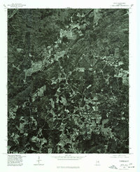 1975 Delta1977 Print · USGSRural Clay County is documented in the mid-seventies through detailed aerial imagery showing the patchwork of forest and field. Genealogists and researchers can trace the roads connecting Delta, Needmore, and the vicinity of Christiana.
 - 1975 Map of Goodwater SW, 1977 Print
 1975 Goodwater SW1977 Print · USGSCoosa County, Alabama is shown here at the height of the 1970s through high-contrast aerial imagery. Local researchers and genealogists can trace the rural road networks and land clearings surrounding Stewartville, Hollins, and Hanover.
Showing maps 1-25 of 38
Top cities of Clay County
Frequently asked questions
- What are the different types of historical maps available for Clay County?
- What is the oldest map of Clay County?
- Where can I purchase historical maps of Clay County for my home or office?
- Where can I download high-res historical maps of Clay County?
- Are there historical topographic maps available for Clay County?
- Is there historical aerial imagery available for Clay County?
- Where are historical maps of Clay County sourced from?