Old Maps of Cleburne County, Alabama for Academic Research
Study the evolution of Cleburne County with 182 high-resolution historic maps. Whether you're teaching, researching, or modeling changes in land use, these maps provide essential visual documentation of urban, environmental, and geographic change.
- Analyze long-term change: Track patterns in development, transportation, and natural features.
- Ideal for environmental or urban studies: Support academic projects with primary historical map data.
- Use in the classroom or lab: Educators and researchers rely on these maps to bring historical context to life.
These maps are a powerful tool for teaching, research, and visualizing how Cleburne County has changed over the decades.
Cleburne County, AL maps
(182)- 1889 Map of Tallapoosa
 1889 Tallapoosa1889 Print · USGSAcross the Georgia and Alabama border in the late nineteenth century, iron furnaces and river mills powered the local economy. Genealogists can trace family homesteads near landmarks like Tecumseh Furnace, Pine Wood Church, and Allgood's Mill.
 - 1891 Map of Ashland
 1891 Ashland1891 Print · USGSEast Central Alabama in the late nineteenth century is defined by the sharp ridges of the mountains and the vital crossings of the Tallapoosa River. Genealogists can trace family movements across Malone's Ferry or locate vanished sites like the Pine Tuckey Town Site and Ironaton.5 unique versions available
 - 1892 Map of Tallapoosa
 1892 Tallapoosa1892 Print · USGSThe Georgia-Alabama borderlands at the end of the nineteenth century reveal a landscape of early industry and river-powered mills. Genealogists and historians can trace family-named landmarks like Allgood Mill, Rainwater Ford, and the Tecumseh Furnace ruins.
 - 1897 Map of Tallapoosa
 1897 Tallapoosa1897 Print · USGSThe Georgia and Alabama borderlands are captured here in the late nineteenth century as the railroad and milling industries reshaped the landscape. Researchers can trace family-named sites like Munroe Mill, early crossings at Rainwater Ford, and old depots at Rockrun Station.4 unique versions available
 - 1899 Map of Wedowee, 1958 Print
 1899 Wedowee1958 Print · USGSEastern Alabama and western Georgia are mapped here at the close of the nineteenth century, documenting the rural river-and-rail landscape. Researchers can trace historic crossings like Philpots Ferry and early industrial sites such as the Copper Mine.
 - 1900 Map of Anniston
 1900 Anniston1900 Print · USGSNortheast Alabama thrived as a railroad and industrial crossroads at the turn of the century. Genealogists and researchers can trace family landmarks and early transport hubs from the Coosa River to Anniston, including Salt Creek Church and Fowler Ferry.6 unique versions available
 - 1902 Map of Wedowee
 1902 Wedowee1902 Print · USGSThe Alabama and Georgia state line bisects this turn-of-the-century landscape of river crossings and hill-country settlements. Genealogists can trace early homesteads and commerce at Philpots Ferry, the Copper Mine, or the town of Wedowee.3 unique versions available
 - 1947 Map of Oxford, 1953 Print
 1947 Oxford1953 Print · USGSThe Choccolocco Creek valley in the late 1940s shows the growth of Oxford and Hobson City near the foothills. Researchers can trace local landmarks like Oxford Lake, Trinity Ch, and the old Southern railroad line.2 unique versions available
 - 1950 Map of Anniston, 1953 Print
 1950 Anniston1953 Print · USGSAnniston and its surrounding military installations dominate this mid-century Alabama survey during a period of significant regional growth. Researchers can trace the footprints of Fort McClellan, locate rural centers like Bynum and Munford, and find old local landmarks such as Wayside Community Ch and Oxford Lake.2 unique versions available
 - 1953 Map of Atlanta, 1965 Print
 1953 Atlanta1965 Print · USGSThe growing Atlanta metro and the industrial corridors of Eastern Alabama are captured here during the mid-century transition. Researchers can trace the rail-to-road shift through hubs like Anniston and La Grange or locate sites within Fort McClellan.2 unique versions available
 - 1954 Map of Choccolocco, 1955 Print
 1954 Choccolocco1955 Print · USGSEastern Alabama in the mid-fifties is defined here by the intersection of military lands and national forest near the SOUTHERN railroad. Genealogists and historians can locate old landmarks like Whitesides Mill, Old Davisville, and the Pleasant Ridge Ch Cem.5 unique versions available
 - 1956 Map of Oxford, 1960 Print
 1956 Oxford1960 Print · USGSOxford and Hobson City were expanding into the Alabama valley during the mid-fifties as the national forest remained a wild southern anchor. Genealogists can trace family footprints through numerous rural landmarks like Salt Creek Cem, Friendship Sch, and the County Training Sch.3 unique versions available
 - 1957 Map of Atlanta
 1957 Atlanta1957 Print · USGSAtlanta and the Alabama borderlands appear here in the mid-fifties, capturing the region's post-war suburban and industrial transition. Trace the development of early transport hubs and military sites like Fort McPherson, Anniston, and the Kennesaw Mountain National Battlefield Park.
 - 1958 Map of Atlanta
 1958 Atlanta1958 Print · USGSMid-century Georgia and Alabama are shown in this regional study of the corridor between the Chattahoochee River and the Appalachian foothills. Local historians can trace the development of suburban Atlanta alongside vital landmarks like Stone Mountain, Dobbins AFB, and the Seaboard Air Line rail routes.
 - 1965 Map of Tallapoosa South, 1968 Print
 1965 Tallapoosa South1968 Print · USGSHaralson County and the Alabama borderlands are captured here in the mid-1960s, centered on the transit hub of Tallapoosa. Genealogists and local historians can trace rural family sites like Pleasant Hill School, Antioch Cemetery, and Sanders Church.2 unique versions available
 - 1966 Map of Tallapoosa North, 1967 Print
 1966 Tallapoosa North1967 Print · USGSThe Alabama and Georgia borderlands in the 1960s were defined by the winding Tallapoosa River and a network of rural congregations. Genealogists and local historians can locate several rural landmarks including the West Haralson Sch, Steadman Missionary Cem Ch, and Pleasant Hill Ch.
 - 1966 Map of Borden Springs, 1967 Print
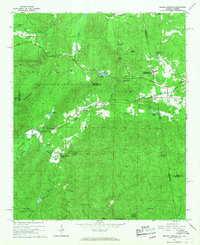 1966 Borden Springs1967 Print · USGSSettlements along the Alabama-Georgia border were defined by the railroads and furnace industry in the 1960s. Genealogists and historians can locate family landmarks like Arrington Chapel Cem, the site of Tecumseh Furnace, and Borden Wheeler Springs.3 unique versions available
 - 1966 Map of Hightower, 1968 Print
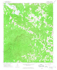 1966 Hightower1968 Print · USGSEastern Alabama's upland ridges and river bottoms are captured here in the mid-1960s as rural life centered on the local church and mill. Researchers can locate family landmarks like Bell Mills, the high points of Turkey Heaven Mountain, and the isolated Forshorn Cem.
 - 1966 Map of Bowdon West, 1968 Print
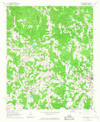 1966 Bowdon West1968 Print · USGSThe Alabama-Georgia state line cuts through this 1960s landscape between the settlements of Ranburne and Bowdon. Genealogists can trace family roots through numerous local landmarks, including Indian Creek Ch, Hudson School, and Macedonia.3 unique versions available
 - 1966 Map of Oak Level, 1968 Print
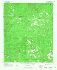 1966 Oak Level1968 Print · USGSCleburne County, Alabama, is captured in the mid-1960s as a landscape of national forest and quiet rural settlements along the Georgia border. Genealogists and hikers can trace old family sites and mountain congregations at Oak Level, Mars Hill Cem, and Campground Ch.3 unique versions available
 - 1966 Map of Fruithurst, 1968 Print
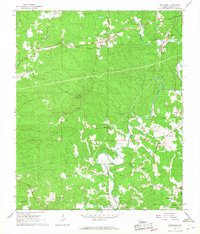 1966 Fruithurst1968 Print · USGSSettlement along the Southern railroad in Cleburne County thrived during the mid-sixties as small communities followed the Tallapoosa River. Researchers can trace rural life through landmarks like Mount Olive Cem, Abernathy, and the Oak Grove Lookout Tower.2 unique versions available
 - 1967 Map of Piedmont NW, 1969 Print
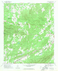 1967 Piedmont NW1969 Print · USGSNortheast Alabama in the late sixties reveals a landscape of mountain ridges and rail-side settlements. Genealogists can trace family landmarks and rural life through Knightens Crossroads, Webb Sch, and the historic tracks of the Southern Railway.3 unique versions available
 - 1967 Map of Ross Mountain, 1969 Print
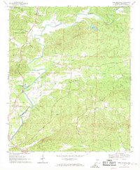 1967 Ross Mountain1969 Print · USGSCleburne County, Alabama, is shown here in the late sixties as a landscape of timbered ridges and winding river bottoms. Genealogists can locate family landmarks like Arbacoochee, Lockchelooge, and several rural sanctuaries including Oak Hill Ch and Hepsibah Ch.3 unique versions available
 - 1967 Map of Piedmont, 1969 Print
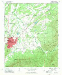 1967 Piedmont1969 Print · USGSPiedmont and the surrounding valleys of the Alabama Piedmont are captured in the late sixties as the region's rail networks and mountain industry thrived. Researchers can trace family sites from McFrey Crossroads to Vigo, or locate old landmarks like Bethune Ch and Goshen Cem.3 unique versions available
 - 1967 Map of Heflin, 1970 Print
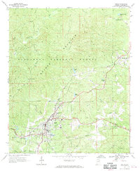 1967 Heflin1970 Print · USGSCleburne County's landscape in the late sixties reveals a mix of national forest land and growing town centers. Genealogists can trace family names at Black Cemetery, visit the Heflin Training School, or explore the rail-linked community of Edwardsville.3 unique versions available
Showing maps 1-25 of 182
Top cities of Cleburne County
- Heflin historical maps
- Hollis Crossroads historical maps
- Ranburne historical maps
- Fruithurst historical maps
- Edwardsville historical maps
Frequently asked questions
- What are the different types of historical maps available for Cleburne County?
- What is the oldest map of Cleburne County?
- Where can I purchase historical maps of Cleburne County for my home or office?
- Where can I download high-res historical maps of Cleburne County?
- Are there historical topographic maps available for Cleburne County?
- Is there historical aerial imagery available for Cleburne County?
- Where are historical maps of Cleburne County sourced from?